
Veeneikroute (yellow)
Unpaved path (partly)
Good
2 Ratings
Rate this route
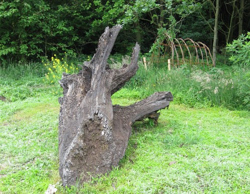
The Veeneikroute (yellow) near Diemen is an extension of this walk via beautiful forest paths. The route is named after the prehistoric oaks that once formed a forest here but were killed about three thousand years ago due to high water levels and peat formation. The fossilised oaks can still be found in the soil.
-
 To add this route in the app: scan the QR code from within the app. or enter the route number 80612 in.
 - 3.73 km
-
 Closed route
-
 Soon-to-be closed route
-
 Reports
-
 Hike point
-
 Starting point
-
 One-way path
Scroll the table below horizontally to see more
![Diemerbos Starting Point [TOP]](/grfx/startpunten/punt_51.png)
| From | To | Segment length | Marking(s) | Characteristics | Reports |
|---|---|---|---|---|---|
|
Diemerbos starting point [top] |
0.06 km |
|
|
|
|
| 0.41 km |
|
|
|
||
| 0.5 km |
|
|
|
||
| 0.36 km |
|
|
|
||
| 0.05 km |
|
|
|
||
| 0.52 km |
|
|
|
||
| 0.07 km |
|
|
|
||
| 0.5 km |
|
|
|
||
| 0.19 km |
|
|
|
||
| 0.43 km |
|
|
|
||
| 0.14 km |
|
|
|
||
| 0.48 km |
|
|
|
||
|
Diemerbos starting point [top] |
0.06 km |
|
|
|