
The Bollekamer

Routes from this starting point
-
Bollekamer (blue)
- 2.97km
-
Hoornderslag (purple)
- 8.38km
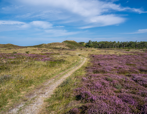
The Bollekamer nature reserve is an old inland dune area with wet heathland valleys. At the end of the 16th century, several farmers and fishermen lived in the hamlet of Borcamer, which was then located along the sea. The dunes and valleys towards Den Hoorn are old and craggy. Marsh gentian and sundews grow among the heather in the wet, slightly acidic soil. Closer to the sea, you can see human influence in the drift dikes and long valleys, such as the Grote Vlak. The Moksloot, constructed in 1880 for agricultural use and later used for water extraction, has also left a visible trail through the landscape. After a redevelopment in 1993, the area is once again flourishing. You might see some of the large grazing cattle used by the Staatsbosbeheer (Dutch Forestry Commission) to help manage the nature in the area. The grassy path can get quite wet at times.
- The Bollekamer Walk (blue) follows a grassy track through the vast dune landscape. You walk up and down along dunes and dune pools. The water in the Grote Vlak valley attracts numerous birds. Flowering yellow irises create a colourful backdrop in spring.
- The Hoornderslag Route (purple) leads from Den Hoorn to the beach at Pole 9. Meandering shell paths take you along the heather-covered dunes and lead to the Loodsmansduin observation point, one of the highest dune tops on the island. The Loodsmansduin is an old command post and offers a beautiful panoramic view over the Bollekamer and the village of Den Hoorn with its iconic white church.