
De Koog

Routes from this starting point
-
De Seeting Route (blue)
- 4.9km
-
Maartenhuis Walk (purple)
- 6.59km
kaart startpunt De Koog (1139 kb)
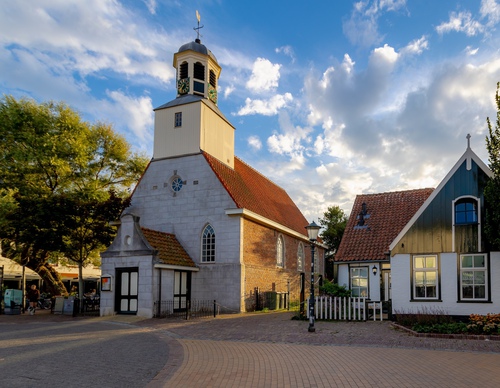
Only a row of dunes separates De Koog from the beach and the sea, which makes the village the top seaside resort of Texel. From the Dorpsstraat, you can walk straight to the beach, making De Koog popular with sunbathers, surfers and other beach lovers. The villagers once lived off herring fishing but nothing remains of this fishing heritage. The little church and the adjacent Mosk farmhouse are the oldest buildings, both of which are now listed national monuments. Duinen van Texel National Park is within easy reach of the village. The wooded dunes on the north side lead to De Slufter via De Muy. Heading south, the Ecomare nature museum and seal sanctuary is nearby.
- The De Seeting Route (blue) is a circular walk along the Zeereeppad and the Kogerstrand beach and through the Seetingsnollen nature reserve managed by Staatsbosbeheer (Dutch Forestry Commission). The Seeting is the name of a narrow, high strip of dunes with coniferous forest, heathland and steep slopes. Its name apparently derives from a 17th century farmer named Ceetingh. The slopes are covered in masses of burnet roses. The route passes Texel's highest point: the Seetingsnol at the edge of the forest (24.8 m).
- The Maartenhuis Walk (purple) is an extension of the blue route across the grounds of this residential and working community for people with special needs. The extra loop passes through a butterfly garden, runs along the banks of Het Alloo dune stream and through the Pelikaanbos forest. In spring, the meadows of Het Alloo turn pink with flowering orchids.