
Nes aan de Amstel Starting Point (tourist transfer point)

Routes from this starting point
-
Dutch Dike Route (blue)
- 8.33km
-
Mill Network Route (red)
- 6.26km
-
Cross Road Route (purple)
- 6.81km
kaart startpunt TOP Nes a/d Amstel 2021 (2390 kb)
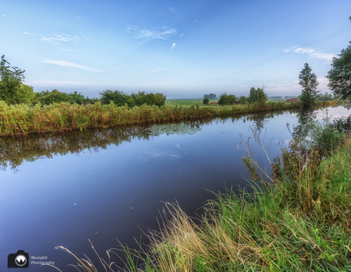
Nes aan de Amstel is wedged between the Amstel river and the ring dike of the Bovenkerkerpolder. The polder is about five metres below sea level. The land drops down a few metres from the dike. In 1769, the polder was drained using eleven windmills. In earlier times, the Nesserlaan was called Kruisweg and, together with the Middenweg, it formed the outline of the reclaimed land. The polder is now a green belt between the built-up areas of Amstelveen and Uithoorn. In 2019, volunteers from the IVN (the Dutch Institute for Nature Education and Sustainability) created a 4 km long 'meadow bird boulevard' along the Middenweg on the land of ten farmers. Godwits and lapwings can hide and forage in this herb-rich strip of land.
- The Hollandse Dijkroute or Dutch Dike Route (blue) is a walk along the towpath on the Amstel, past the ferry at Nessersluis to the Hollandse Dijk in Uithoorn. From the Middenweg you can take two walks along new paths through the farmland.
- The Molengangroute or Mill Network Route (red) passes through the polderland north of the village. Via the ring dike you walk to where three mill networks used to drain onto the higher grounds. One mill stump has been preserved from the mill complex.
Please note that dogs are not allowed and the route is not accessible during the breeding season. - The name Kruiswegroute or Cross Road Route (purple) references the historical name and shape of the reclaimed land. From the village you walk via the towpath along the Amstel to the shell-covered path along the Nesserlaan. There is plenty to enjoy on the straight-as-an-arrow Middenweg.