
Bleekersvallei Route (blue)
Rate this route
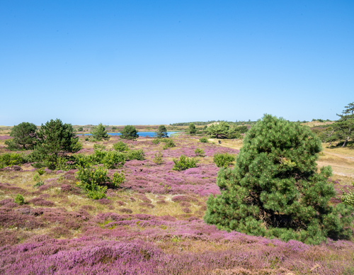
The Bleekersvallei Route (blue) leads you into the dunes via the Ploegelanden. Named after a steamship that ran aground in 1923, the Alesia path connects the hinterland to the vast plains of the Bleekersvallei. Here, heather and dune shrubs bloom along winding shell paths.
-
 To add this route in the app: scan the QR code from within the app. or enter the route number 236364 in.
 - 5.96 km
-
 Closed route
-
 Soon-to-be closed route
-
 Reports
-
 Hike point
-
 Starting point
-
 One-way path
Scroll the table below horizontally to see more

| From | To | Segment length | Marking(s) | Characteristics | Reports |
|---|---|---|---|---|---|
|
Monnikenweg |
0.07 km |
|
|
||
| 0.78 km |
|
|
|||
| 0.73 km |
|
|
|||
| 0.55 km |
|
|
|||
| 1.05 km |
|
|
|||
| 0.31 km |
|
|
|||
| 0.36 km |
|
|
|||
| 1.07 km |
|
|
|||
|
Monnikenweg |
1.03 km |
|
|