
De Hoorn van Texel (black)
Rate this route
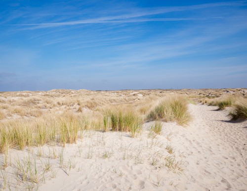
De Hoorn van Texel (black) is a salty journey over old tidal barriers: the traces of past coastlines. Via an impressive dune crossing, you reach the wide beach towards Pole 9. Inland, the bunker lies on the Loodsmansduin overlooking Den Hoorn, the 'cliff' was located directly on the coast until around 1200. Sandbanks merged with the coast and dune formation created tidal barriers such as the Kuuldernollen (now a campsite). Neeltjesnol is another such dune ridge, with beautiful views over Mok Bay and De Hors.
-
 To add this route in the app: scan the QR code from within the app. or enter the route number 236006 in.
 - 10.32 km
-
 Closed route
-
 Soon-to-be closed route
-
 Reports
-
 Hike point
-
 Starting point
-
 One-way path
Scroll the table below horizontally to see more

| From | To | Segment length | Marking(s) | Characteristics | Reports |
|---|---|---|---|---|---|
|
De hors |
0.16 km |
|
|
||
| 0.07 km |
|
|
|||
| 0.53 km |
|
|
|||
| 0.07 km |
|
|
|||
| 0.98 km |
|
|
|||
| 1.13 km |
|
|
|||
| 1.94 km |
|
|
|||
| 1.98 km |
|
|
|||
| 0.82 km |
|
|
|||
| 1.54 km |
|
|
|||
| 0.12 km |
|
|
|||
| 0.93 km |
|
|
|||
|
De hors |
0.05 km |
|
|