
Dune Ridge Route (yellow)
Great
1 Ratings
Rate this route
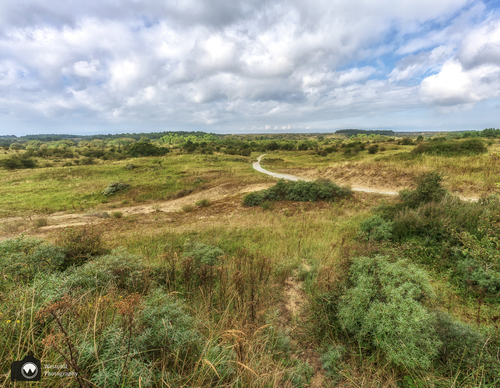
The Dune Ridge Route (yellow) in Bloemendaal takes you through the Zuid-Kennemerland National Park along the flanks of the dune ridges that arose between 1400 and 1600. Along valleys with striking names such as Kleine Tobbe and Dronken Del you walk to the Konijnenberg and Starreberg lookout points.
-
 To add this route in the app: scan the QR code from within the app. or enter the route number 187848 in.
 - 9.84 km
-
 Closed route
-
 Soon-to-be closed route
-
 Reports
-
 Hike point
-
 Starting point
-
 One-way path
Scroll the table below horizontally to see more

| From | To | Segment length | Marking(s) | Characteristics | Reports |
|---|---|---|---|---|---|
|
Starting point bleek en berg bloemendaal |
0.08 km |
|
|
||
| 0.89 km |
|
|
|||
| 0.81 km |
|
|
|||
| 1.03 km |
|
|
|||
| 0.96 km |
|
|
|||
| 1.54 km |
|
|
|||
| 0.1 km |
|
|
|||
| 0.47 km |
|
|
|||
| 0.91 km |
|
|
|||
| 0.39 km |
|
|
|||
| 0.34 km |
|
|
|||
| 0.73 km |
|
|
|||
| 0.41 km |
|
|
|||
| 0.47 km |
|
|
|||
| 0.64 km |
|
|
|||
|
Starting point bleek en berg bloemendaal |
0.08 km |
|
|