
Hoornderslag (purple)
Good
1 Ratings
Rate this route
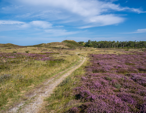
The Hoornderslag Route (purple) leads from Den Hoorn to the beach at Pole 9. Meandering shell paths take you along the heather-covered dunes and lead to the Loodsmansduin observation point, one of the highest dune tops on the island. The Loodsmansduin is an old command post and offers a beautiful panoramic view over the Bollekamer and the village of Den Hoorn with its iconic white church.
-
 To add this route in the app: scan the QR code from within the app. or enter the route number 236000 in.
 - 8.38 km
-
 Closed route
-
 Soon-to-be closed route
-
 Reports
-
 Hike point
-
 Starting point
-
 One-way path
Scroll the table below horizontally to see more

| From | To | Segment length | Marking(s) | Characteristics | Reports |
|---|---|---|---|---|---|
|
The bollekamer |
0.93 km |
|
|
||
| 0.06 km |
|
|
|||
| 0.2 km |
|
|
|||
| 1.1 km |
|
|
|||
| 0.15 km |
|
|
|||
| 0.08 km |
|
|
|||
| 0.96 km |
|
|
|||
| 1.98 km |
|
|
|||
| 1.29 km |
|
|
|||
|
The bollekamer |
1.27 km |
|
|