
In the footsteps of Saint Willibrord
Good
1 Ratings
Rate this route
This attractive route for pilgrims and other walkers follows inspiringly in the footsteps of Willibrord across the former island of Wieringen. From the starting point in Den Oever, the route passes through Westerland, Hippolytushoef, Oosterland and several hamlets.
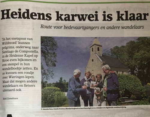
Around the year 700, a small church was built at Stroe (a hamlet on Wieringen), said to have been founded by Willibrord himself. After some time, the wooden structure was replaced by a building of tuff, featuring a carved stone with the image of a pig – a pagan symbol. In 2016, the Heidense Kapel (pagan chapel) at Stroe was rebuilt. Pilgrims can pause here and collect a stamp in their walking booklet.
The route and accompanying booklet, which contains extensive information on local history, were prepared by volunteers. The booklet (€3.50) is available from the Wieringen Island Jan Lont Museum in Stroe, the Viking Information Centre in Den Oever and the Wieringen bookshop in Hippolytushoef. It can also be ordered by emailing Marieke Roos, foundation chair of the Stichting Heidense Kapel Wieringen at gemroos@kpnplanet.nl.
At certain points, the route described in the booklet differs from the walking network. These sections are marked with a white arrow featuring a red-and-white chapel symbol. In such cases, follow the route booklet.
More information: http://www.heidensekapel.info/heidense-kapel-stroe/in-het-voetspoor-van-de-heilige-willibrord/
-
 To add this route in the app: scan the QR code from within the app. or enter the route number 83791 in.
 - 26.90 km
-
 Closed route
-
 Soon-to-be closed route
-
 Reports
-
 Hike point
-
 Starting point
-
 One-way path

| From | To | Segment length | Marking(s) | Characteristics | Reports |
|---|---|---|---|---|---|
|
Starting point wieringen |
0.29 km |
|
|
||
|
Starting point wieringen |
0.48 km |
|
|
||
| 0.56 km |
|
|
|||
| 0.7 km |
|
|
|||
| 1.88 km |
|
|
|||
| 0.18 km |
|
|
|||
| 0.99 km |
|
|
|||
|
Starting point stroe |
0.19 km |
|
|
||
|
Starting point stroe |
0.69 km |
|
|
||
| 0.17 km |
|
|
|||
| 1.28 km |
|
|
|||
|
Starting point hippolytushoef |
1.58 km |
|
|
||
|
Starting point hippolytushoef |
0.05 km |
|
|
||
| 0.27 km |
|
|
|||
| 0.32 km |
|
|
|||
| 1.31 km |
|
|
|||
| 0.53 km |
|
|
|||
| 1.18 km |
|
|
|||
| 1.28 km |
|
|
|||
|
Starting point westerland |
0.75 km |
|
|
||
|
Starting point westerland |
Starting point de haukes |
1.86 km |
|
|
|
|
Starting point de haukes |
0.13 km |
|
|
||
| 1.18 km |
|
|
|||
| 0.72 km |
|
|
|||
| 1.3 km |
|
|
|||
| 0.86 km |
|
|
|||
| 1.39 km |
|
|
|||
| 2.13 km |
|
|
|||
| 0.47 km |
|
|
|||
| 1.19 km |
|
|
|||
| 1 km |
|
|