
Noorderdijk Route (orange)
Average
1 Ratings
Rate this route
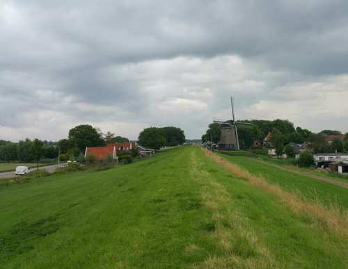
From the Wieringerwaard starting point, the Noorderdijk Route (orange) passes Het Polderhuis (1612), the first building in the polder, used as a water board office, police station and town hall. It continues past the impressive water tower (1928) and the mill area, where De Hoop (1742) still stands proudly as the only one of four former mills. It leads along the green Noorderdijk to the attractive dyke hamlet of Nieuwesluis. It also passes the restored tram station of the Schagen–Van Ewijcksluis steam tram line (1912–1934). The route is waymarked in both directions with orange arrows.
-
 To add this route in the app: scan the QR code from within the app. or enter the route number 56395 in.
 - 6.03 km
-
 Closed route
-
 Soon-to-be closed route
-
 Reports
-
 Hike point
-
 Starting point
-
 One-way path

| From | To | Segment length | Marking(s) | Characteristics | Reports |
|---|---|---|---|---|---|
|
Starting point wieringerwaard |
1.07 km |
|
|
||
| 1.39 km |
|
|
|||
|
Starting point nieuwesluis |
0.65 km |
|
|
||
|
Starting point nieuwesluis |
0.24 km |
|
|
||
| 0.67 km |
|
|
|||
|
Starting point wieringerwaard |
2.01 km |
|
|