
Ploegelanden Route (purple)
Rate this route
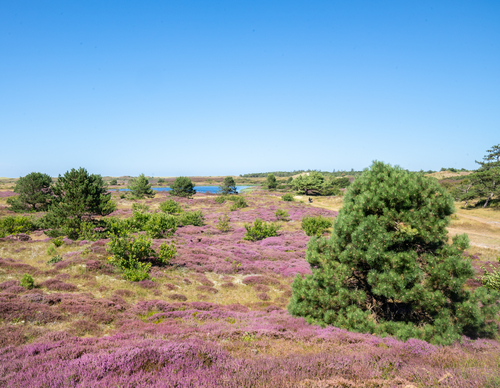
The Ploegelanden Route (purple) leads from the forest to open grassland, where large grazers are used for nature management. Since 2001, Staatsbosbeheer (Dutch Forestry Commission) has been working to restore this transitional area between dune and polder. Wander past dune streams and ponds.
-
 To add this route in the app: scan the QR code from within the app. or enter the route number 236360 in.
 - 3.11 km
-
 Closed route
-
 Soon-to-be closed route
-
 Reports
-
 Hike point
-
 Starting point
-
 One-way path
Scroll the table below horizontally to see more

| From | To | Segment length | Marking(s) | Characteristics | Reports |
|---|---|---|---|---|---|
|
Monnikenweg |
0.07 km |
|
|
||
| 0.78 km |
|
|
|||
| 0.15 km |
|
|
|||
| 1.07 km |
|
|
|||
|
Monnikenweg |
1.03 km |
|
|