
Tureluur Walk (orange)
Rate this route
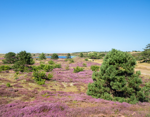
The Tureluur Walk (orange) passes through a diverse landscape. The path takes you past the redesigned Tureluur and Schettersweid, where dune streams with natural banks embellish the landscape and where plants such as orchids, sundews and marsh lousewort grow.
-
 To add this route in the app: scan the QR code from within the app. or enter the route number 236362 in.
 - 4.09 km
-
 Closed route
-
 Soon-to-be closed route
-
 Reports
-
 Hike point
-
 Starting point
-
 One-way path
Scroll the table below horizontally to see more

| From | To | Segment length | Marking(s) | Characteristics | Reports |
|---|---|---|---|---|---|
|
Monnikenweg |
0.57 km |
|
|
||
| 1.15 km |
|
|
|||
| 0.74 km |
|
|
|||
| 0.43 km |
|
|
|||
| 1.14 km |
|
|
|||
|
Monnikenweg |
0.07 km |
|
|