
Starting Point Liniedijk

Routes from this starting point
-
Lange Jaap Route (green)
- 8.76km
-
Nolletjes Route (yellow)
- 10.63km
-
Fort Kijkduin Route (purple)
- 7.46km
Themed routes from this starting point
-
Napoleon Route (orange)
- 11.22km
wandelkaart startpunt Liniedijk (1971 kb)
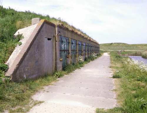
The line dykes of the Stelling Den Helder were constructed between 1824 and 1825 on the orders of William I. These dykes connect the forts Erfprins, Dirksz Admiraal, Westoever and Oostoever, which were built earlier under Napoleon, and made it possible to flood the low-lying foreland (the Buitenveld or Koegras) if an enemy army approached. This was a real concern, as the Anglo-Russian invasion of 1799 had exposed this as weakness of the naval base. The Stelling Den Helder was further expanded and remained in military use until the Second World War.
- The green Lange Jaap Route runs along the covered way behind the Liniedijk and runs to Fort Dirksz Admiraal, the railway station, the town centre and the sea dyke. At Oude Helder, it runs to the red Lange Jaap lighthouse (1878). The route is waymarked in both directions with green arrows.
- The yellow Nolletjes Route runs to De Helderse Vallei and the undulating salt-marsh dunes (‘nollen’) near Den Helder Zuid station. The route is waymarked in both directions with yellow arrows.
- The purple Fort Kijkduin Route follows the Liniedijk northwards past Fort Erfprins with its green ravelins, then runs along the sea dyke to Huisduinen.
- The orange Napoleon Route runs along the covered way behind the Liniedijk, with a detour to Fort Kijkduin, which now houses a museum and North Sea aquarium.