
Starting Point Waarland

Before the reclamation works of the 1550s–1590s, this area consisted of an archipelago of small islands in reed beds and shallow lakes. Waarland was therefore written as Waertland (low-lying land). It originated in the Middle Ages through the reclamation of raised peat bog. Topographic maps from 1865 show market gardens with long, narrow plots. Post-war land consolidation has largely erased this characteristic landscape, but much remains to be seen and experienced – for example in the green nature zone along the Alkmaar-Kolhorn Canal, and in the Boomerwaal nature reserve, a remnant of a dyke breach.
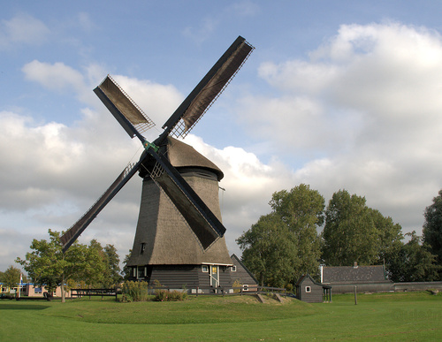
- The orange Schaapskuilmeer Circular Walk passes the Waertmolen and runs westwards through the polder along a farm track. Through the Bleekmeerpolder, the route follows the grass dyke along the north bank of the Alkmaar-Kolhorn Canal.
- The green Klein Rondje Waarland runs through the old village and along the dead-end Oostkade to the high footbridge over the Boomervaart. It then follows the grass dyke along the canal and returns to the village along the unpaved Waardkade on the south bank. Dogs are not allowed on the farm tracks.