
Starting Point Wieringerwaard

Routes from this starting point
-
Noorderdijk Route (orange)
- 6.03km
-
Noordwesterdijk Route (paars)
- 9.51km
wandelkaart startpunt Wieringerwaard (1901 kb)
Initially, the Wieringerwaard, reclaimed in 1610–1611, was known as the Nieuwe Zijpe, as it was seen as an extension of the Zijpe, which had been definitively reclaimed in 1597. The Wieringerwaard stretches from Oudesluis to the Westfriese Omringdijk. In 1844, a further section was added by building a dyke out into the mudflats. This Waardpolder lies between Nieuwesluis and Kolhorn on the old land. Together, it forms one of the most attractive polders in the country, thanks to its calm, spacious layout in large square blocks. As a Renaissance polder, it served as a successful precursor to the drainage of the Beemster in 1612.
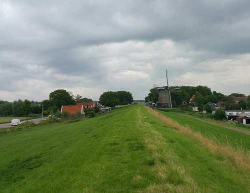
- The orange Noorderdijk Route runs past Het Polderhuis. It continues past the impressive water tower and the mill area. It leads along the green Noorderdijk to the attractive dyke hamlet of Nieuwesluis. Along the way, it also passes the restored tram station of the Schagen–Van Ewijcksluis steam tram line. The route is waymarked in both directions with orange arrows.
- The purple Noordwesterdijk Route partly follows the Noorderdijk Route, then climbs the high grass dyke at De Hoop windmill towards Oudesluis, with wide views over the western part of the Wieringerwaard and the Oostpolder of Anna Paulowna. The route is waymarked in both directions with purple arrows.