
Starting Point Nieuwesluis

Routes from this starting point
-
Noorderdijk Route (orange)
- 6.03km
-
Waardkanaal Route (blue)
- 9.12km
wandelkaart startpunt Nieuwesluis (1742 kb)
Nieuwesluis is an attractive dyke hamlet in the north-east corner of Wieringerwaard. It is hard to imagine that this was intended to become the centre and harbour of the polder after the reclamation of 1610–1611. Nieuwesluis was initially the largest settlement, but it was soon overtaken by the mill area further west, near the church, the school and Het Polderhuis: the present-day village of Wieringerwaard. A memorial stone in Nieuwesluis commemorates the 1916 flood, when a large part of the Anna Paulowna polder was inundated. It was installed by the polder board in 1918, shortly after the Noorderdijk and Oosterdijk had been substantially raised.
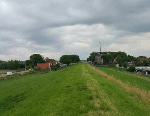
- The Noorderdijk Route (orange) from Nieuwesluis runs along the green Noorderdijk to the mill area, where De Hoop (1742) still stands proudly as the only survivor of four former mills. The route then passes the striking water tower (1938) and Het Polderhuis (1612) in Wieringerwaard, the first building in the polder, used over time as a water board office, police station and town hall. It also passes the restored tram station, a remnant of the Schagen–Van Ewijcksluis steam tram line (1912–1934), now an attractive national monument. The route is waymarked in both directions with orange arrows.
- The blue Waardkanaal Route near Nieuwesluis runs diagonally towards Kolhorn along the high grass dyke beside the Waardkanaal, with wide views over the Waardpolder to the west and the Wieringermeer to the east.