
Ouderkerk aan de Amstel Starting Point

Routes from this starting point
-
Ommetje Bullewijk (red)
- 2.2km
-
Zwaan Route (blue)
- 2.78km
-
Duivendrechtse Polderroute (yellow)
- 7.42km
-
Amstel Back and Forth (black)
- 8.86km
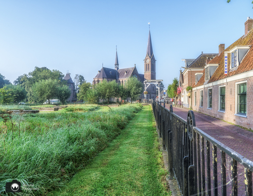
Ouderkerk aan de Amstel is located in the Amstelscheg, an open and green area between the built-up area of Amsterdam, and is perfect for walking and cycling. The land at the confluence of the Amstel and the Bullewijk was reclaimed in the 11th century. There was probably a castle here at one time belonging to the Van Amstel family. Part of the village is a protected townscape. There are several national monuments, including the De Zwaan windmill and the Jewish cemetery Beth Haim (House of Life), which was built for the Jewish community in Amsterdam at the beginning of the 17th century.
- The Ommetje Bullewijk or Bullewijk Walk (red) is a short stroll along the banks of the former peat stream the Bullewijk. The old Kerkbrug (Church Bridge) is a national monument.
- The Zwaan Route (blue) runs along the Amstel to the De Zwaan windmill via the village centre. This mill dates from 1638 and served the polder called the Klein-Duivendrechtse and Binnenbullewijkerpolder op de Amstel.
- The Duivendrechtse Polderroute (yellow) continues north along the Amstel and back via the Klein-Duivendrechtse Polder. This polder is popular with meadow birds such as lapwings and oystercatchers and is closed during the breeding season.
- The Amstel Heen en Weer or Amstel Back and Forth (black) is a somewhat longer circular walk to the south along the banks of the Amstel with beautiful views over the Rondehoep polder.
Note: In April and September, the ferry across the Amstel only sails on Saturdays, Sundays and public holidays (Noon - 6 pm) and then daily from May to August (Noon - 6 pm).
Photo: Westphil Photography