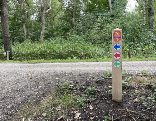
Starting point Bennebroek (tourist transfer point)

Routes from this starting point
-
Trambaan Route (red)
Unpaved path (partly) - 3.61km
-
Rottegat Route (blue)
Unpaved path (partly) - 5.33km
Bennebroek was probably originally wet peatland ('broek') belonging to a Ben on the Haarlemmermeer bank. On the border of the peat and an old beach ridge, the village first developed in a north–south direction (along Schoollaan/Binnenweg), and on the Roohellerzandvaart (now Bennebroekervaart) from the 16th century. The name of the canal was derived from the red colour of the cut peat. Widened and deepened, the canal was important for the removal of sand for the expansions of Amsterdam. The sand excavation sites marked the surroundings. The dune was excavated just above the groundwater. At this spot, you stand on flat sandy soil that reaches to the border with Heemstede, where it rises steeply at the Overplaats estate. The sand excavation areas were used by bleach houses and then bulb growers.
- The Trambaan Route (red) runs partly along the route of the former Haarlem–Leiden tramline and the ponds of the bird-rich Bennebroekbos, once the park of Huis te Bennebroek. Along the way is a beautiful view of the 17th-century Reformed Church. In the village, you walk along the old road on the border of embankment and peat bog (Schoollaan). If you look closely, you can see long-eared owls roosting in a tree.
- The Rottegat Route (blue) in Bennebroek extends the Trambaan Route with a corridor to and along the Ringvaart of the Haarlemmermeer Polder and through the greenery around the Rottegat, once a duck decoy, now a sports park.
- The Buitenplaatsen Path (yellow-green stickers) is also included in the network. This 18.6-kilometre route consists of several loops marked in one direction. For more information, go to www.landschapnoordholland.nl.

