
Starting point Leyduin Vogelenzang

Routes from this starting point
-
Leyduin Route (red)
- 4.63km
Themed routes from this starting point
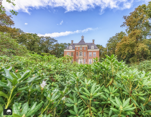
Landgoed Leyduin estate is located on one of the old beach ridges behind the dunes, which were already inhabited in the early Bronze Age (around 2000 BC). The Counts of Holland hunted there in the Middle Ages in De Hout, a forest that stretched from Leiden to Alkmaar. From the 17th century, wealthy merchants bought land there as an investment in sand extraction for the urban development of Amsterdam. They later built summer residences there. Over the centuries, the manor homes grew into increasingly beautiful estates, including Leyduin. The current main building followed on from earlier, beautiful buildings in 1921. Since 1997, Landschap Noord-Holland has managed the estate north of Vogelenzang, where you’ll find some centuries-old trees, a folly and a stream. The first drinking water for Amsterdam extracted in the dunes once flowed here to the pumping station (now museum) on the Leidsevaart.
- The Leyduin Route (red) north of the village of Vogelenzang leads around the nature-rich estate, including the site where there was a horse racing track at the beginning of the last century, complete with grandstand, gambling office and hotel.
The Country Estates Path (green-yellow) between Vogelenzang, Heemstede and Bennebroek is included in the network, go to www.landschapnoordholland.nl.
Photo: Westphil Photography