
Starting Point De Zandloper

Routes from this starting point
-
Noordduinen Route (purple)
- 8.47km
-
Koegras Route (orange)
- 9.39km
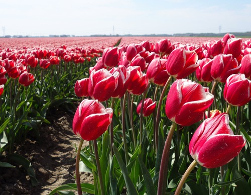
There was a time when the North Sea had free rein in the mudflat behind this area, known as Het Buitenveld or Koegras. This changed in 1612, when the Zanddijk was completed and the sand dyke grew into a dune ridge: the Noordduinen. From then on, conditions became much calmer and the salt marsh gradually silted up. In 1818, the marsh was reclaimed, but this proved unsuccessful due to poor soil, drifting sand and a lack of manure. Around 1900, sheep farming dominated, with dairy farming a strong second. Julianadorp was founded in 1909 and is a relatively young village. It has a church and is named after the newborn Crown Princess Juliana. Only after experienced bulb growers from ‘De Zuid’ (the bulb-growing region around Lisse) arrived did the polder begin a second, more profitable phase: from sheep polder to bulb-growing area. In the 1970s, Den Helder decided to build an expansion district in Julianadorp. Later, several bungalow parks were developed in Julianadorp aan Zee for beach tourism, marking its shift from a bulb-growing village to a seaside resort.
- The purple Noordduinen Route runs south through the Noordduinen, turning at the Callantsogervaart and returning along the green western edge of Julianadorp. In the opposite direction, the same landscapes are experienced from a different perspective. This route is waymarked in both directions with purple arrows.
- The orange Koegras Route runs from Julianadorp through the bulb fields of the Koegras polder, through De Helderse Vallei and the Noordduinen. This route is waymarked in both directions with orange arrows.
This route (in reverse) was the ‘Circular Walk of the Month’ in April 2024, in a feature written by Westphil Wandelt. Read their walking report here.
Scottish Highland cattle graze in parts of the Noordduinen.