
Starting Point Kolhorn

Routes from this starting point
-
Hoogsloot Route (green)
- 3.29km
-
Waardkanaal Route (red)
- 6.03km
-
Kromme Gouw Route (purple)
- 7.15km
-
Gemalenroute (blue)
- 9.49km
-
Groetpolder Route (orange)
- 15.02km
Kolhorn, meaning ‘cold corner’, lies at a bend in the medieval Westfriese Omringdijk. It was an old fishing harbour, already mentioned around 1300 as a transhipment point for seaweed and later also for peat. The village prospered during the Golden Age, when ships of the Dutch East India Company and West India Company were often loaded and unloaded here. After 1824, however, these ships began using the Noordhollandsch Canal to Amsterdam, and the village returned to fishing, peat and seaweed. This too came to an end after the reclamation of the Wieringermeerpolder in 1930.
- The green Hoogsloot Route is a circular walk along the Onderkolk to the village woodland. Spoonbills can sometimes be seen along the shell path beside the main channel of a new pumping station. The route is waymarked in both directions with green arrows.
- The red Waardkanaal Route crosses to the high grass dyke along the Waardkanaal, with wide views over the Waardpolder, a subsidiary polder of the Wieringerwaard from 1847. The route is waymarked in both directions with red arrows.
- The purple Kromme Gouw Route runs along an old peat river and a pre-war canal, partly over grass dykes. The farm track is closed between 1 March and 1 July during the bird breeding season. The route is waymarked in both directions with purple arrows.
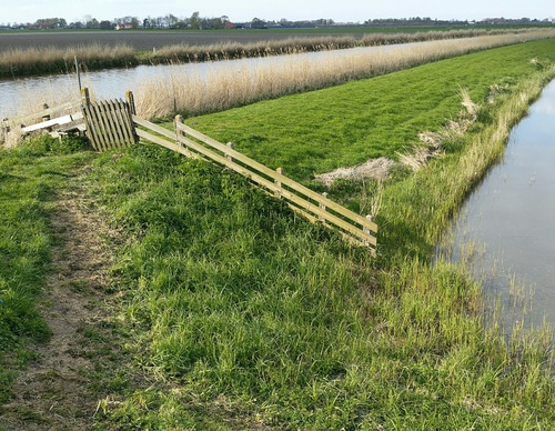
Note: Some grass dykes on the route can be difficult to walk because they are mown only twice a year. Just before mowing, the grass can be very high. Mowing takes place between 1 June and mid-July and between 1 September and 10 October, to minimise disturbance to nature. Such a rough section lies immediately north of marker 63. If the grass is too high, it is possible to leave or rejoin the dyke about 200 metres north-west of marker 63.
- The blue Gemalen Route runs past the disused Schagerkogge pumping station, built in 1927 in Amsterdam School style, then to its predecessor, a steam-powered pumping station from 1871, and its successor, the landscape-integrated Kolhorn pumping station from 2007. It continues along a grass dyke, a former tramway path and the linear village of Barsingerhorn. The route is waymarked in both directions with blue arrows.
This route was featured as the ‘Circular Walk of the Month’ in June 2021, in a feature written by the Westphil Wandelt bloggers. Read their walking report here.
- The orange Groetpolder Route extends the Kromme Gouw Route to the Groetpolder and runs along farm tracks to the grass dyke of the Groetkanaal, with the cooperation of farmers Boekhorst and De Heer. The farm track is closed between 1 March and 1 July during the bird breeding season.
The route is waymarked in both directions with orange arrows. For the protection of breeding meadow birds, part of the route is not accessible between 15 March and 20 June. During this period, the route runs between markers 59 and 62, with a short section at marker 63 marked in purple.
Note: The grass dykes on the route can be difficult to walk because they are mown only twice a year. Just before mowing, the grass can be very high. Mowing takes place between 1 June and mid-July and between 1 September and 10 October, to minimise disturbance to nature.
The Noord-Hollandpad is a long-distance walking route of 284 km, divided into 16 stages from Texel to Huizen. It crosses the inland landscapes of Noord-Holland along farm tracks, past windmills, ditches, canals and woodland, and through distinctive villages. The route is signposted in both directions. Stage 4 runs from Julianadorp to Kolhorn (22 km), stage 5 from Den Oever to Kolhorn (29 km), and stage 6 from Kolhorn to Obdam (21 km). See www.noordhollandpad.nl for more information.