
De Slufter

Routes from this starting point
-
Slufterpad (blue)
- 3.64km
-
Muy- en Slufterbollenroute (orange)
- 11.34km
-
From Slufter to Kaap (green)
- 12.39km
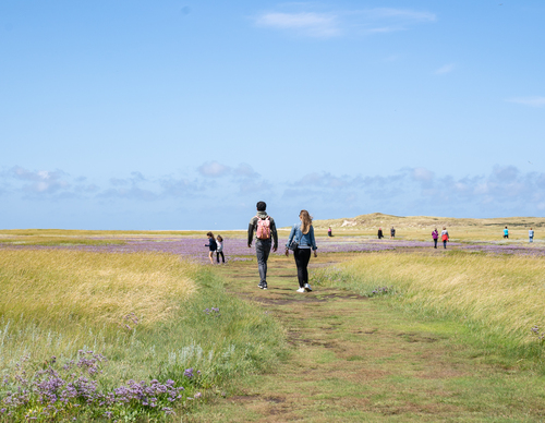
De Slufter is a unique nature reserve that has an open connection to the sea. During heavy storms, the entire creek system floods. The views from the high dune ridge at the Sluftertrap will give you an idea of the immense area that forms part of the Duinen van Texel National Park, which is managed by Staatsbosbeheer (Dutch Forestry Commission). Salt-tolerant plants such as samphire and sea lavender thrive there. The original intention was to reclaim the Slufter and convert it into farmland, but this ultimately failed. Envision this area being made up of two islands until the 16th century: Eierland at the northern tip and Texel below. At that time, the entire area in between was like the Slufter of today: salt marshes with creeks, sand flats and dunes.
- The Slufterpad (blue) is a short round trip through the Slufter to the sea. Walkers and birdwatchers may choose their own path here, but the marked route is a nice mix of dunes, beach and salt marsh.
- The Muy and Slufterbollen Route (orange) connects the Slufter with the forest near De Koog. You walk along a unique stretch of beach and through a young dune area with high dune tops and freshwater creeks.
- The From Slufter to Kaap linear walk (green) traverses the island and mainly crosses farmland in the polders of Eierland. The route was created by ANLV De Lieuw Texel together with local farmers. It’s a delightful journey past fields and creeks to the IJzeren Kaap on the Wadden Sea Dike near Oosterend.