
Starting Point De Helderse Vallei

Routes from this starting point
-
Mariendal route (green)
- 2.15km
-
Donkere Duinen route (blue)
- 6.1km
-
Grafelijkheidsduinenroute (red)
- 8.72km
-
Koegrasroute (orange)
- 9.4km
-
Nolletjesroute (yellow)
- 11.4km
-
Helderse Vallei Route (black)
- 2.63km
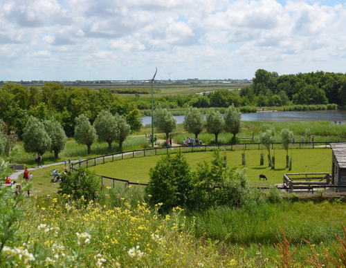
De Helderse Vallei is a nature centre located between De Donkere Duinen woodland, De Helderse Duinen nature area and the Mariëndal recreational area. A lookout tower next to the visitor centre offers panoramic views. A nature area where you can walk freely, created in 2005, lies to the south of Mariëndal. Former bulb fields have been transformed into low dune mounds, dune grasslands and water features, including a bird lake with a naturally fluctuating water level – wet in winter and drier in summer. The routes run alongside this area rather than through it, but it can be explored freely on foot from marker 96, heading south.
- The green Mariëndal Route is a short exploration of this wooded valley. The route is waymarked in both directions with green arrows.
- The blue Donkere Duinen Route runs along the 17th-century Zanddijk and the foredunes, and through the Donkere Duinenbos. The route is waymarked in both directions with blue arrows.
- The red Grafelijkheidsduinen Route runs along the foredunes to Fort Kijkduin in Huisduinen, returning along the eastern edge of the Grafelijkheidsduinen and through the Donkere Duinenbos. The route is waymarked in both directions with red arrows.
- The orange Koegras Route runs through the bulb fields of the Koegras polder to the ‘De Zandloper’ beach access point in Julianadorp aan Zee, returning through the Noordduinen. The route is waymarked in both directions with orange arrows.
- The yellow Nolletjes Route runs to the Liniedijk and the green ravelin of Fort Dirksz Admiraal, part of the Stelling Den Helder military line, and continues to the undulating salt-marsh dunes (‘nollen’) near Den Helder Zuid station. The route is waymarked in both directions with yellow arrows. The route is waymarked in both directions with yellow arrows.
- The black Helderse Vallei Route explores the southern edge of the dune area and the adjoining Mariëndal nature area. The route is waymarked in both directions with black arrows.
The Noord-Hollandpad is a long-distance walking route (284 km), divided into 16 stages, running from Texel to Huizen. It crosses the inland landscapes of Noord-Holland along farm tracks, past windmills, ditches, canals and woodland, and through distinctive villages. The route is signposted in both directions. Stage 3 runs from Den Helder to Julianadorp (15 km). For more information, see www.noordhollandpad.nl.