
Mooie Nel Walk (black)
Good
3 Ratings
Rate this route
Dogs are allowed to be off-leash in certain parts of this route. Specific areas are indicated by signage from the municipality or land manager. Always follow the rules at the location and clean up after your dog.
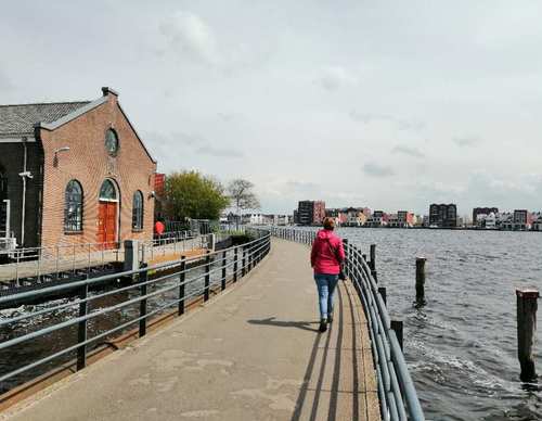
During the Mooie Nel Walk (black) you walk towards Penningsveer and back to Spaarndam via Haarlem. Along the route you can see the expansive waters of the Binnenliede and the Spaarne from all sides. Even from above, from the former landfill.
-
 To add this route in the app: scan the QR code from within the app. or enter the route number 189581 in.
 - 10.53 km
-
 Closed route
-
 Soon-to-be closed route
-
 Reports
-
 Hike point
-
 Starting point
-
 One-way path
Scroll the table below horizontally to see more

| From | To | Segment length | Marking(s) | Characteristics | Reports |
|---|---|---|---|---|---|
|
Starting point spaarndam |
0.19 km |
|
|
||
| 0.67 km |
|
|
|||
| 0.69 km |
|
|
|||
| 0.46 km |
|
|
|||
| 0.54 km |
|
|
|||
| 0.44 km |
|
|
|||
| 0.34 km |
|
|
|||
| 1.26 km |
|
|
|||
| 0.54 km |
|
|
|||
| 0.3 km |
|
|
|||
| 1.43 km |
|
|
|||
| 0.07 km |
|
|
|||
| 0.49 km |
|
|
|||
| 2.58 km |
|
|
|||
| 0.33 km |
|
|
|||
| 0.02 km |
|
|
|||
|
Starting point spaarndam |
0.19 km |
|
|