
North-Holland Route
A part of this route is closed from 15-03-2026 to 15-06-2026
Great
1 Ratings
Rate this route
Dogs are allowed to be off-leash in certain parts of this route. Specific areas are indicated by signage from the municipality or land manager. Always follow the rules at the location and clean up after your dog.
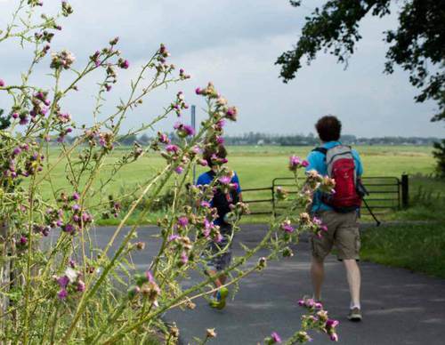
The ‘Helderse Duinen’ themed route combines nature, culture and the maritime history of Den Helder. It runs through dunes, woodland and polder landscapes, along winding paths in the dunes and also along the solid dyke with fine views over the sea, where naval vessels, submarines and sometimes seals can be seen. Along the way are historical forts, the distinctive Lange Jaap lighthouse and several museums. It is also possible to visit De Nollen and De Helderse Vallei. From the dyke, it’s just a short stroll to the town centre of Den Helder and the former naval dockyard Rijkswerf Willemsoord, with its historic ships and plenty of places to eat and drink for a well-earned break.
- 1. De Cocksdorp - De Waal
- 2. De Waal – Den Helder
- 3. Den Helder - Julianadorp
- 4. Julianadorp - Wieringerwaard
- 5. Wieringerwaard - Kolhorn
- 6. Den Oever - De Haukes
- 7. De Haukes - Kolhorn
- 8. Kolhorn - Obdam
- 9. Obdam - Schermerhorn
- 10. Schermerhorn - Akersloot
- 11. Akersloot - Krommenie
- 12. Krommenie - Halfweg
- 13. Halfweg - Ouderkerk aan de Amstel
- 14. Ouderkerk aan de Amstel - Abcoude
- 15. Abcoude - 's Graveland
- 16. 's Graveland - Huizen
The route starts and ends at a railway station and is therefore easy to reach by public transport. It can be followed using the waymark posts of the Noord-Holland Hiking Network. More information is available on the NS website.
-
 To add this route in the app: scan the QR code from within the app. or enter the route number 15245 in.
 - 182.81 km
-
Closed route
-
 Soon-to-be closed route
-
 Reports
-
 Hike point
-
 Starting point
-
 One-way path


| From | To | Segment length | Marking(s) | Characteristics | Reports |
|---|---|---|---|---|---|
|
Starting point den helder station |
1.31 km |
|
|
||
| 1.74 km |
|
|
|||
| 0.87 km |
|
|
|||
| 0.92 km |
|
|
|||
| 0.15 km |
|
|
|||
| 0.41 km |
|
|
|||
| 1.83 km |
|
|
|||
| 0.1 km |
|
|
|||
| 0.16 km |
|
|
|||
| 0.28 km |
|
|
|||
| 3.66 km |
|
|
|||
| 0.69 km |
|
|
|||
| 0.65 km |
|
|
|||
| 0.61 km |
|
|
|||
| 1.35 km |
|
|
|||
| 3.81 km |
|
|
|||
| 0.05 km |
|
|
|||
| 2.21 km |
|
|
|||
| 3.57 km |
|
|
|||
| 1.88 km |
|
|
|||
| 0.03 km |
|
|
|||
| 3.28 km |
|
|
|||
| 0.73 km |
|
|
|||
| 1.39 km |
|
|
|||
|
Startpunt nieuwesluis |
0.65 km |
|
|
||
|
Startpunt nieuwesluis |
0.24 km |
|
|
||
| 3.93 km |
|
|
|||
| 3.09 km |
|
|
|||
| 0.16 km |
|
|
|||
| 0.14 km |
|
|
|||
| 0.27 km |
|
|
|||
| 0.2 km |
|
|
|||
| 3.19 km |
|
|
|||
| 1.97 km |
|
|
|||
| 2.28 km |
|
|
|||
| 0.68 km |
|
|
|||
| 1.04 km |
|
|
|||
| 1.24 km |
|
|
|||
| 0.26 km |
|
|
|||
|
Starting point 't verlaat |
0.5 km |
|
|
||
|
Starting point 't verlaat |
0.93 km |
|
|
||
| 2.46 km |
|
|
|||
| 1.36 km |
|
|
|||
| 1.02 km |
|
|
|||
| 0.66 km |
|
|
|||
| 0.65 km |
|
|
|||
| 0.14 km |
|
|
|||
| 2.24 km |
|
|
|||
| 0.17 km |
|
|
|||
| 1.63 km |
|
|
|||
| 1.32 km |
|
|
|||
| 2.48 km |
|
|
|||
| 1.46 km |
|
|
|||
| 0.82 km |
|
|
|||
| 1.13 km |
|
|
|||
|
Startpunt ursem |
0.27 km |
|
|
||
|
Startpunt ursem |
0.36 km |
|
|
||
| 0.14 km |
|
|
|||
| 0.04 km |
|
|
|||
| 1.98 km |
|
|
|||
| 1.1 km |
|
|
|||
|
Startpunt schermerhorn |
0.08 km |
|
|
||
|
Startpunt schermerhorn |
3.99 km |
|
|
||
| 1.09 km |
|
|
|||
| 0.67 km |
|
|
|||
| 0.18 km |
|
|
|||
| 2.27 km |
|
|
|||
| 0.54 km |
|
|
|||
| 0.16 km |
|
|
|||
|
Startpunt driehuizen |
0.07 km |
|
|
||
|
Startpunt driehuizen |
0.11 km |
|
|
||
| 4.12 km |
|
|
|||
|
Startpunt uiterdam |
1.95 km |
|
|
||
|
Startpunt uiterdam |
0.01 km |
|
|
||
| 0.09 km |
|
|
|||
| 0.98 km |
|
|
|||
| 0.32 km |
|
|
|||
|
Startpunt klaas hoorn (toeristisch overstappunt) |
0.2 km |
|
|
||
|
Startpunt klaas hoorn (toeristisch overstappunt) |
0.75 km |
|
|
||
| 0.64 km |
|
|
|||
| 1.21 km |
|
|
|||
| 0.61 km |
|
|
|||
| 1.36 km |
|
|
|||
| 0.18 km |
|
|
|||
| 0.18 km |
|
|
|||
| 0.34 km |
|
|
|||
| 1.67 km |
|
|
|||
| 0.51 km |
|
|
|||
| 0.22 km |
|
|
|||
| 1.02 km |
|
|
|||
| 0.3 km |
|
|
|||
| 0.35 km |
|
|
|||
| 1.72 km |
|
|
|||
| 1.5 km |
|
|
|||
| 2.14 km |
|
|
|||
| 0.04 km |
|
|
|||
| 0.51 km |
|
|
|||
| 0.98 km |
|
|
|||
|
Starting point fort veldhuis-aagtendijk |
0.26 km |
|
|
||
| 0.95 km |
|
|
|||
| 0.54 km |
|
|
|||
| 1.64 km |
|
|
|||
| 0.5 km |
|
|
|||
| 3.86 km |
|
|
|||
| 0.8 km |
|
|
|||
|
Startpunt buitenhuizen assendelft (toeristisch overstappunt) |
0.15 km |
|
|
||
|
Startpunt buitenhuizen assendelft (toeristisch overstappunt) |
0.4 km |
|
|
||
| 0.39 km |
|
|
|||
| 1.09 km |
|
|
|||
| 0.1 km |
|
|
|||
| 0.46 km |
|
|
|||
| 1.51 km |
|
|
|||
| 1.79 km |
|
|
|||
| 1.63 km |
|
|
|||
| 1.59 km |
|
|
|||
|
Starting point halfweg-zwanenburg station (tourist transfer point) |
0.11 km |
|
|
||
|
Starting point halfweg-zwanenburg station (tourist transfer point) |
0.15 km |
|
|
||
| 1.24 km |
|
|
|||
| 1.22 km |
|
|
|||
| 1.32 km |
|
|
|||
| 1.5 km |
|
|
|||
| 2.63 km |
|
|
|||
| 2.63 km |
|
|
|||
| 3.21 km |
|
|
|||
| 0.54 km |
|
|
|||
| 1.24 km |
|
|
|||
| 0.14 km |
|
|
|||
|
De boswinkel (visitor centre) starting point |
0.37 km |
|
|
||
|
De boswinkel (visitor centre) starting point |
0.13 km |
|
|
||
|
Uilenstede starting point |
1.5 km |
|
|
||
|
Uilenstede starting point |
1.24 km |
|
|
||
|
Middelpolder starting point (tourist transfer point) |
0.48 km |
|
|
||
|
Middelpolder starting point (tourist transfer point) |
0.26 km |
|
|
||
| 0.16 km |
|
|
|||
| 0.11 km |
|
|
|||
| 0.25 km |
|
|
|||
| 0.82 km |
|
|
|||
| 0.06 km |
|
|
|||
| 1.46 km |
|
|
|||
| 0.14 km |
|
|
|||
| 1.02 km |
|
|
|||
| 0.3 km |
|
|
|||
| 0.69 km |
|
|
|||
|
Elsenhove amstelveen starting point (touris transfer point) |
0.19 km |
|
|
||
|
Elsenhove amstelveen starting point (touris transfer point) |
0.19 km |
|
|
||
| 0.32 km |
|
|
|||
| 0.53 km |
|
|
|||
| 0.26 km |
|
|
|||
| 0.52 km |
|
|
|||
| 1.26 km |
|
|
|||
| 1.21 km |
|
|
|||
| 0.26 km |
|
|
|||
| 0.79 km |
|
|
|||
| 1.37 km |
|
|
|||
|
Nes aan de amstel starting point (tourist transfer point) |
0.59 km |
|
|
||
|
Nes aan de amstel starting point (tourist transfer point) |
0.18 km |
|
|
||
| 0.39 km |
|
|
|||
| 0.63 km |
|
|
|||
| 0.1 km |
|
|
|||
| 0.12 km |
|
|
|||
| 1.75 km |
|
|
|||
| 2.05 km |
|
|
|||
| 0.07 km |
|
|
|||
| 2.1 km |
|
|
|||
| 1.94 km |
|
|
|||
| 1.93 km |
|
|
|||
| 0.05 km |
|
|
|||
| 0.04 km |
|
|
|||
|
Startpunt 's-gravelandse buitenplaatsen |
0.39 km |
|
|
||
|
Startpunt 's-gravelandse buitenplaatsen |
0.04 km |
|
|
||
| 0.32 km |
|
|
|||
| 0.29 km |
|
|
|||
| 0.82 km |
|
|
|||
| 0.04 km |
|
|
|||
| 0.28 km |
|
|
|||
| 0.3 km |
|
|
|||
| 1.37 km |
|
|
|||
| 1.43 km |
|
|
|||
| 1.17 km |
|
|
|||
| 2.11 km |
|
|
|||
| 0.44 km |
|
|
|||
| 0.81 km |
|
|
|||
| 0.36 km |
|
|
|||
| 0.23 km |
|
|
|||
| 0.45 km |
|
|
|||
| 2.26 km |
|
|
|||
|
Startpunt huizer museum |
0.03 km |
|
|
||
|
Startpunt huizer museum |
0.23 km |
|
|
||
| 0.1 km |
|
|
|||
| 0.66 km |
|
|
|||
|
Startpunt nautisch kwartier |
0.42 km |
|
|