
Purple route from starting point Sint Maartenszee
Average
4 Ratings
Rate this route
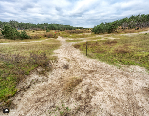
The purple route runs along shell paths past wind-shaped trees to the wet dune valleys of Het Korfwater. It then returns along the northern edge of the Pettemerduinen, managed by Staatsbosbeheer (Dutch Forestry Commission) over the Zijperzeedijk and past the Energy Research Centre of the Netherlands (ECN), where research is carried out into sustainable energy innovation.
-
 To add this route in the app: scan the QR code from within the app. or enter the route number 2527 in.
 - 5.45 km
-
 Closed route
-
 Soon-to-be closed route
-
 Reports
-
 Hike point
-
 Starting point
-
 One-way path
Scroll the table below horizontally to see more
| From | To | Segment length | Marking(s) | Characteristics | Reports |
|---|---|---|---|---|---|
|
Starting point sint maartenszee |
0.1 km |
|
|
||
| 1.75 km |
|
|
|||
| 0.16 km |
|
|
|||
| 0.24 km |
|
|
|||
| 0.89 km |
|
|
|||
| 0.64 km |
|
|
|||
| 0.41 km |
|
|
|||
| 0.02 km |
|
|
|||
| 0.39 km |
|
|
|||
| 0.58 km |
|
|
|||
| 0.24 km |
|
|
|||
|
Starting point sint maartenszee |
0.1 km |
|
|