
Red route from starting point Petten
Average
8 Ratings
Rate this route
The red route runs along the imposing Hondsbossche Zeewering and the Oude Schoorlse Zeedijk, a grass dyke that winds around the Abtskolk, rich in birdlife, a remnant of a breach in 1570.
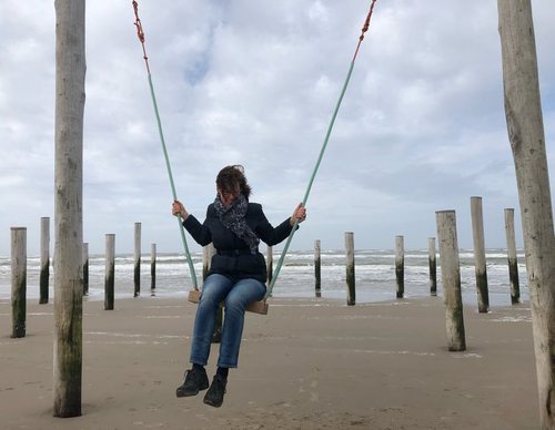
At marker 90, the beach at Palendorp is well worth a short stop. This striking artwork consists of 160 posts arranged in the shape of ten houses and a church, recalling the old village of Petten, long since lost to the sea.
-
 To add this route in the app: scan the QR code from within the app. or enter the route number 2459 in.
 - 7.86 km
-
 Closed route
-
 Soon-to-be closed route
-
 Reports
-
 Hike point
-
 Starting point
-
 One-way path
Scroll the table below horizontally to see more

| From | To | Segment length | Marking(s) | Characteristics | Reports |
|---|---|---|---|---|---|
|
Starting point petten |
0.05 km |
|
|
||
| 0.34 km |
|
|
|||
| 0.99 km |
|
|
|||
| 2.44 km |
|
|
|||
| 1.61 km |
|
|
|||
|
Starting point leipolder |
0.29 km |
|
|
||
|
Starting point leipolder |
0.06 km |
|
|
||
| 1.19 km |
|
|
|||
| 0.07 km |
|
|
|||
| 0.51 km |
|
|
|||
| 0.09 km |
|
|
|||
| 0.2 km |
|
|
|||
|
Starting point petten |
0.05 km |
|
|