
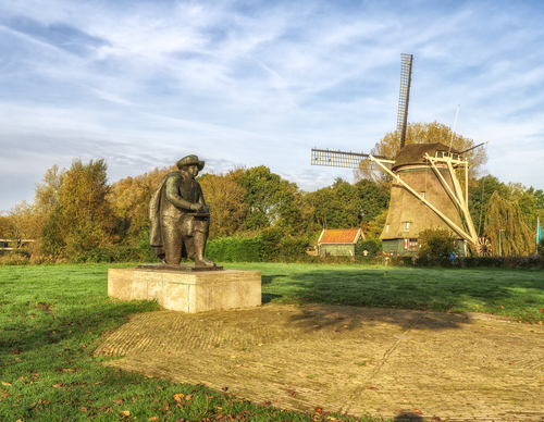
Riekermolen Route (green)
Good
1 Ratings
Rate this route
The Riekermolen Route (green) links Amsterdamse Bos and Amstelpark with the much-photographed Riekermolen on the Amstel. Follow the green corridors along Kalfjeslaan and Gijsbrecht van Aemstelpark. Alternative routes are available where dogs are not permitted.
Photo: Westphil Photography
-
 To add this route in the app: scan the QR code from within the app. or enter the route number 132542 in.
 - 8.66 km
-
 Closed route
-
 Soon-to-be closed route
-
 Reports
-
 Hike point
-
 Starting point
-
 One-way path
Scroll the table below horizontally to see more

| From | To | Segment length | Marking(s) | Characteristics | Reports |
|---|---|---|---|---|---|
|
Uilenstede starting point |
1.42 km |
|
|
||
| 0.09 km |
|
|
|||
|
De boswinkel (visitor centre) starting point |
0.13 km |
|
|
||
|
De boswinkel (visitor centre) starting point |
0.37 km |
|
|
||
| 0.14 km |
|
|
|||
| 2.77 km |
|
|
|||
| 1.08 km |
|
|
|||
| 0.62 km |
|
|
|||
| 0.09 km |
|
|
|||
| 0.23 km |
|
|
|||
| 0.47 km |
|
|
|||
|
Uilenstede starting point |
1.24 km |
|
|