Slaperdijk Route (blue)
Moderate
5 Ratings
Rate this route
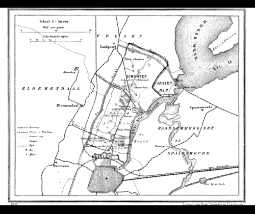
The Slaperdijk Route (blue) from TOP Santpoort-Zuid connects the inland dune edge with the outskirts of Spaarndam and the two forts of the Defence Line of Amsterdam. You walk along the Jan Gijzenvaart canal, dug in 1537, and the vast polder landscape of Spaarnwoude. The Hekslootpolder served as a firing range of the Defence Line of Amsterdam and was not allowed to be built on. Now lapwings, godwits, geese and Eurasian coots settle here. You return to the station along the old Slaperdijk, which used to hold back the water.
-
To add this route in the app: scan the QR code from within the app. or enter the route number 11751 in.
- 7.95 km
-
 Closed route
-
 Soon-to-be closed route
-
 Reports
-
 Hike point
-
 Starting point
-
 One-way path
| From | To | Segment length | Marking(s) | Characteristics | Reports |
|---|---|---|---|---|---|
|
Starting point station santpoort-zuid (tourist transfer point) |
0.11 km |
|
|
|
|
| 1.21 km |
|
|
|
||
| 0.06 km |
|
|
|
||
| 1.84 km |
|
|
|
||
| 2.21 km |
|
|
|
||
| 0.5 km |
|
|
|
||
| 1.89 km |
|
|
|
||
|
Starting point station santpoort-zuid (tourist transfer point) |
0.11 km |
|
|
|


