
Zand tegen Zee Route
Good
9 Ratings
Rate this route
A detailed and informative description is available for the Zand tegen Zee Route.
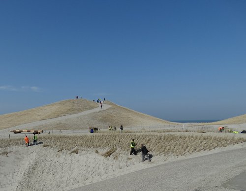
The route runs along the Pettemer Zeewering and its recently formed foredunes, and along the Hazedijk of the Zijpe. It continues for a considerable distance along the beach, over shell paths and through the wet dune valleys of Het Korfwater.
-
 To add this route in the app: scan the QR code from within the app. or enter the route number 6605 in.
 - 9.01 km
-
 Closed route
-
 Soon-to-be closed route
-
 Reports
-
 Hike point
-
 Starting point
-
 One-way path
Scroll the table below horizontally to see more

| From | To | Segment length | Marking(s) | Characteristics | Reports |
|---|---|---|---|---|---|
|
Starting point petten |
0.05 km |
|
|
||
| 0.2 km |
|
|
|||
| 0.79 km |
|
|
|||
| 0.9 km |
|
|
|||
|
Starting point leipolder |
0.29 km |
|
|
||
|
Starting point leipolder |
0.06 km |
|
|
||
| 1.19 km |
|
|
|||
| 0.76 km |
|
|
|||
| 1.98 km |
|
|
|||
| 0.15 km |
|
|
|||
| 0.89 km |
|
|
|||
| 0.27 km |
|
|
|||
| 0.78 km |
|
|
|||
| 0.53 km |
|
|
|||
|
Starting point petten |
0.21 km |
|
|