
Monnikenweg

Routes from this starting point
-
Ploegelanden Route (purple)
- 3.11km
-
Tureluur Walk (orange)
- 4.09km
-
De Mient Nature Trail (red)
- 4.46km
-
Bleekersvallei Route (blue)
- 5.96km
kaart startpunt Monnikenweg (989 kb)
Where paths now run through herb-filled meadows and forests, there used to be open dune and heathland in medieval times. A monastery is said to have been located here but its remains have never been found. However, the remains of a bleachery were found in the Ploegelanden. The adjacent dune valley owes its name to it.
Paths in the area can occasionally be wet.
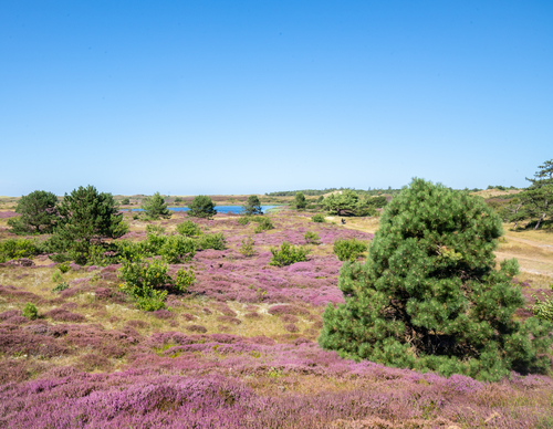
- The Ploegelanden Route (purple) leads from the forest to open grassland, where large grazers are used for nature management. Since 2001, Staatsbosbeheer (Dutch Forestry Commission) has been working to restore this transitional area between dune and polder. Wander past dune streams and ponds.
- The Tureluur Walk (orange) passes through a diverse landscape. The path takes you past the redesigned Tureluur and Schettersweid, where dune streams with natural banks embellish the landscape and where plants such as orchids, sundews and marsh lousewort grow.
- De Mient Nature Trail (red) leads through a changing landscape. The once damp heathlands at the inner dune edge, later production forest, have been enriched with deciduous forest and pretty clearings. Put on your walking shoes for a delightful journey across wooded dune ridges, heathland and damp lowlands.
- The Bleekersvallei Route (blue) leads you into the dunes via the Ploegelanden. Named after a steamship that ran aground in 1923, the Alesia path connects the hinterland to the vast plains of the Bleekersvallei. Here, heather and dune shrubs bloom along winding shell paths.