
Search results
Characteristics
Quick search
426 results
Region
Length
Characteristics
 (deels) gesloten")
Het oude land (yellow)
The Het oude land walking route (yellow) leads along winding dikes past herb-covered grassy polders towards the historic local paths on the Hoge Berg. Farmland paths through meadows with sheep and oystercatchers provide an idyllic glimpse of Texel’s rural life.
9.2 km- (0)
 (deels) gesloten")
Skéép en Lantskap Route (green)
The Skéép en Lantskap Route (green) was developed by ANLV De Lieuw Texel in collaboration with local farmers. You follow a lovely grassy path over an old dike, towards the harbour lock dating from 1465, once the gateway to 'Den Horn'. You walk the black route during the breeding season.
5.43 km- (0)
 (deels) gesloten")
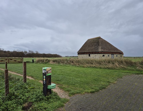
Wezenspyk Landscape Path (black)
The Wezenspyk Landscape Path (black) is short but sweet. Walk along the grassy embankment to the cable ferry and the sheep museum, where you can learn about sheep farming and the landscape. Can’t you get enough? Then stop by the farm shop.
2.42 km- (0)
 (deels) gesloten")
Polderpracht Route (red)
The Polderpracht Route (red) is a long loop between the grassland and creeks and along the Ruigendijk. Outside the breeding season, sheep graze in the pastures. In autumn and winter, it is bursting with migratory birds, wigeons and ducks.
8.3 km- (0)
 (deels) gesloten")
Loopie Waalenburg Walk (blue)
The Loopie Waalenburg Walk (blue) leads you through colourful meadows, where you can enjoy the song of the skylark high above the land.
2.74 km- (0)
 (deels) gesloten")
De Marel Circular Walk (white)
The De Marel Circular Walk (white) is a short walk to get acquainted with the beauty of the polder full of flowers and birds. The fully paved walk is suitable for prams and wheelchairs and includes a short round trip to a nice observation point.
1.82 km- (0)
 (deels) gesloten")
Eierlandse Gat Circular Walk (red)
The Eierlandse Gat Circular Walk (red) is an elongated loop. The seaward side of the loop is a narrow and popular stretch of beach towards the jetty of the Wadden ferry 'De Vriendschap'. With a bit of luck, you might see a seal sticking its head out of the water. The landward side runs along the
3.77 km- (0)
 (deels) gesloten")
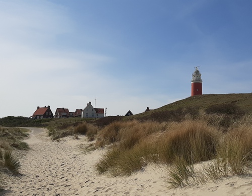
Lighthouse Route (blue)
The Lighthouse Route (blue) runs through the Eierlandse Dunes and over a wide beach to the lighthouse. The fields along the path are called the Tuintjes (gardens) because they used to be the gardens of the lighthouse keepers. Just before the transition from dune to beach, you pass an observation
3.59 km- (0)
 (deels) gesloten")
Westerduin Route (black)
The Westerduin Route (black) is a circular route via the dune edge and the wide beach. The shell path winds through undulating dunes and valleys with burnet roses, a gull colony and, if you’re lucky, you could even spot a hen harrier. Those who climb the Kampeersnol at the end will be rewarded
5.6 km- (1)
 (deels) gesloten")
De Dennen Route (purple)
On the De Dennen Route (purple) you dive into the shelter of the green surroundings. The path winds between tall trunks up to the observation tower on the Fonteinsnol. Stately pines dominate the forest, until the path leads you into a beech forest with pretty dappled sunlight.
3.85 km- (0)