
Search results
Characteristics
Quick search
426 results
Region
Length
Characteristics
 (deels) gesloten")
De Muy- en Slufterbollen Route (orange)
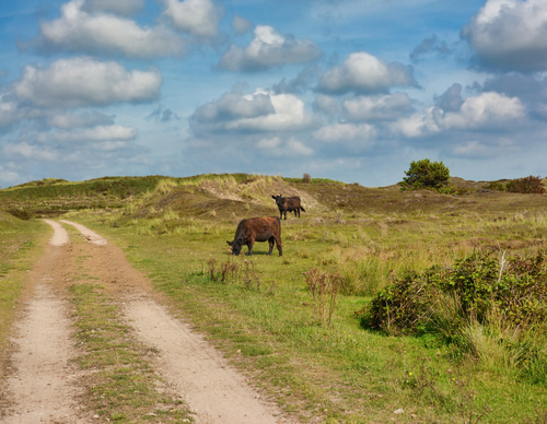
De Muy and Slufterbollen Route (orange) connects the Slufter with the forest near De Koog. You walk along a unique stretch of beach and through a dune area managed by Staatsbosbeheer with high dune tops and freshwater creeks.
10.71 km- (0)
 (deels) gesloten")
Bertusnol Circular Walk (blue)
The Bertusnol Circular Walk (blue) is a lovely walk through the dunes of De Muy. The route travels along the foredune to the high Bertusnol. Climb the stairs to the top of the dune and be rewarded with a beautiful panoramic view.
3.69 km- (0)
 (deels) gesloten")
Alloo Nature Trail (red)
The Alloo Nature Trail (red) leads through dunes, forest and, above all, along the banks of Het Alloo dune stream. The walk cuts across the grounds of the Maartenhuis, a residential community for people with special needs. You will find a butterfly garden and the charming De Windroos restaurant
4.97 km- (0)
 (deels) gesloten")
Paggapad (black)
The Paggapad (black) is a trail that follows the footsteps of Kees 'Pagga' Gorter, the last islander to live in a turf hut. His nickname possibly derived from 'pagan', or heath dweller. The route connects one such old heathland to the beach, via grazed grasslands and the wooded Gortersmient.
4.79 km- (0)
 (deels) gesloten")
Hoge Nol Circular Walk (orange)
The Hoge Nol Circular Walk (orange) skirts around the foredune and the dune top that gives the route its name. In the lowlands of Het Alloo, there is a bird-watching screen at the edge of the forest where you can spy on meadow birds in the flower-filled grassland.
4.31 km- (0)
 (deels) gesloten")
Vissers Circular Walk (red)
The entirely paved Vissers Circular Walk (red) leads to where the people of Oosterend had an oyster harbour in the 19th century. The now-vanished harbour at Nieuweschild provided a safe mooring for the little boats. On the Wadden Sea Dike, you pass a striking cast-iron ship's beacon from 1854, the
5.4 km- (0)
 (deels) gesloten")
Boeren Circular Walk (blue)
The Boeren Circular Walk (blue) leads through gently rolling grassland. You can see here that Oosterend lies on a somewhat higher moraine. The garden walls, known as ‘tuunwallen’ on Texel, are a particularly charming highlight of this circular walk. The path between stacked turf walls leads to
4.77 km- (0)
 (deels) gesloten")
Bleekersvallei Route (blue)
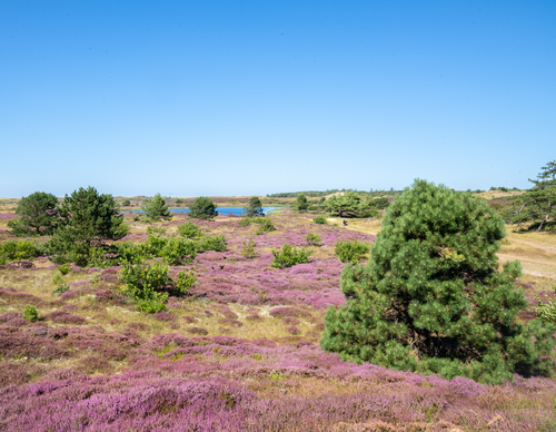
The Bleekersvallei Route (blue) leads you into the dunes via the Ploegelanden. Named after a steamship that ran aground in 1923, the Alesia path connects the hinterland to the vast plains of the Bleekersvallei. Here, heather and dune shrubs bloom along winding shell paths.
5.96 km- (0)
 (deels) gesloten")
De Mient Nature Trail (red)
De Mient Nature Trail (red) leads through a changing landscape. The once damp heathlands at the inner dune edge, later production forest, have been enriched with deciduous forest and pretty clearings. Put on your walking shoes for a delightful journey across wooded dune ridges, heathland and damp
4.46 km- (1)
 (deels) gesloten")
Tureluur Walk (orange)
The Tureluur Walk (orange) passes through a diverse landscape. The path takes you past the redesigned Tureluur and Schettersweid, where dune streams with natural banks embellish the landscape and where plants such as orchids, sundews and marsh lousewort grow.
4.09 km- (0)