
Search results
Characteristics
Quick search
426 results
Region
Length
Characteristics
 (deels) gesloten")
Ploegelanden Route (purple)
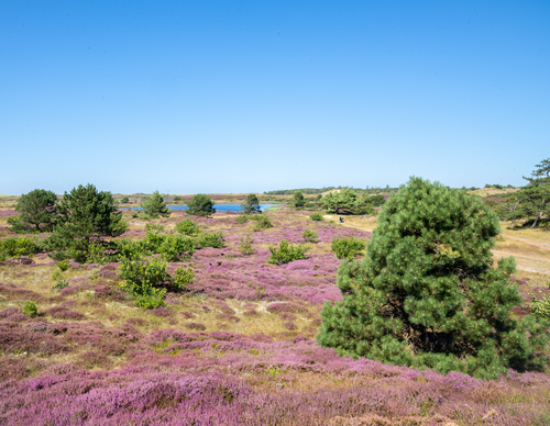
The Ploegelanden Route (purple) leads from the forest to open grassland, where large grazers are used for nature management. Since 2001, Staatsbosbeheer (Dutch Forestry Commission) has been working to restore this transitional area between dune and polder. Wander past dune streams and ponds.
3.11 km- (0)
 (deels) gesloten")
Pieter Rozenvlak Route (red)
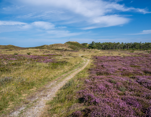
The Pieter Rozenvlak Route (red) follows a wide grassy path through the old dune landscape with wet heathland valleys. Along the way, you will pass dune pools, heather and the bunkers of coastal battery Den Hoorn. Note: the route passes through grazing land and the paths can occasionally be wet.
3.2 km- (0)
 (deels) gesloten")
Okusnol Circular Walk (blue)
The Okusnol Circular Walk (blue) extends the orange route with adventurous paths through the forest. Some tough climbs await on the Okusrichel dune ridge. Fortunately, the conifers offer shelter from the wind while creating beautifully dappled sunlight.
3.59 km- (0)
 (deels) gesloten")
Het Geheim (orange)
Het Geheim (The Secret) (orange) is a surprising and varied circular walk. You walk along a path across the heath to the cheerful Knobbelpad along the forest edge. The forest conceals some striking Scots pines, which were secretly sown by former forester Min during the forest's construction. This
2.64 km- (0)
 (deels) gesloten")
From Slufter to Kaap (green)
The From Slufter to Kaap linear walk (green) traverses the island and mainly crosses farmland in the polders of Eierland. It’s a delightful journey past fields and creeks between the Wadden Sea Dike and the North Sea. With its nature-friendly embankments, the Hogezandskil nature reserve has
12.39 km- (0)
 (deels) gesloten")
Vissers Circular Walk (red)
The entirely paved Vissers Circular Walk (red) leads from the IJzeren Kaap along the dike and over quiet roads to Oosterend. In the picturesque fishing village, the circular walk route leads to the church square via cobbled streets and alleys.
5.28 km- (0)
 (deels) gesloten")
Het oude land (yellow)
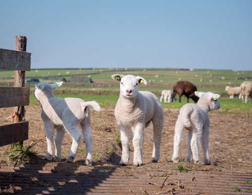
The Het oude land (the old land) walking route (yellow) leads along winding dikes and past herb-covered polders. Farmland paths through meadows with sheep and oystercatchers showcase the rural life of Texel.
9.2 km- (0)
 (deels) gesloten")
Traces of the Reede (orange)
Traces of the Reede (orange) extends the red route via a meandering shell path along the Skilsloot canal to the Wadden Sea. This historic drinking water connection from the Wezenputten (Orphan wells) dates back to the glory days of the 'Reede van Texel' anchorage site. The outer dike path along the
7 km- (1)
 (deels) gesloten")
Burg and Berg Route (purple)
The Burg and Berg Route (purple) goes to the charming village centre of Den Burg and back. You walk along historic local paths with garden walls known as 'tuunwallen' - traditional Texel property divisions made of stacked turf.
5.23 km- (0)
 (deels) gesloten")
Paths from De Waddel to Brakestein (green)
The Paths from De Waddel to Brakestein (green) are managed by ANLV De Lieuw Texel and form a charming circular walk through the sheep pastures along natural banks and the Brakestein manor house. Please note that your dog is not allowed in the sheep pastures.
4.18 km- (0)