
Search results
Characteristics
Quick search
426 results
Region
Length
Characteristics
 (deels) gesloten")
Around De Krim Route (blue)
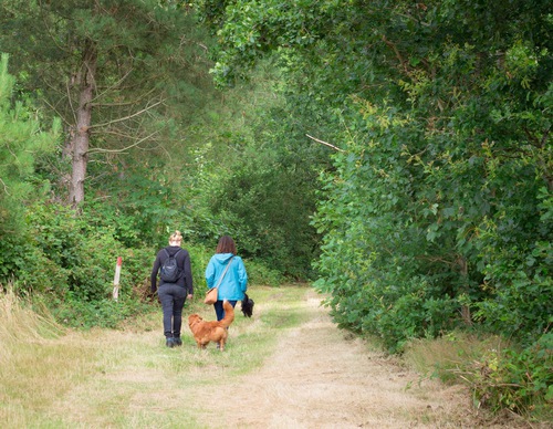
The Around De Krim Route (blue) is a walk of two halves: one half journeys through young forest with lovely views of the bulb fields, while the southern section leads along the edges of the golf course, overlooking marshy grassland and dunes.
5.73 km- (0)
 (deels) gesloten")
The Dorpzicht Walk (yellow)
The Dorpzicht Walk (yellow) was created at the initiative of De Cocksdorp’s village committee and is a beautiful route for villagers, tourists and birdwatchers. The nature reserve along the old Roggesloot tidal creek consists of sparse grasslands rich in flowers. Walkers are treated to the sight
5.33 km- (0)
 (deels) gesloten")
Maartenhuis Walk (purple)
The Maartenhuis Walk (purple) is an extension of the blue route across the grounds of this residential and working community for people with special needs. The extra loop passes through a butterfly garden, runs along the banks of Het Alloo dune stream and through the Pelikaanbos forest. In spring,
6.59 km- (0)
 (deels) gesloten")
De Seeting Route (blue)
The De Seeting Route (blue) is a circular walk along the Zeereeppad and the Kogerstrand beach and through the Seetingsnollen nature reserve managed by Staatsbosbeheer (Dutch Forestry Commission). The Seeting is the name of a narrow, high strip of dunes with coniferous forest, heathland and steep
4.9 km- (0)
 (deels) gesloten")
De Hoorn van Texel (black)
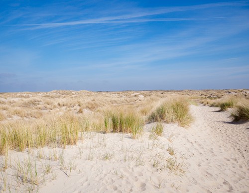
De Hoorn van Texel (black) is a salty journey over old tidal barriers: the traces of past coastlines. Via an impressive dune crossing, you reach the wide beach towards Pole 9. Inland, the bunker lies on the Loodsmansduin overlooking Den Hoorn, the 'cliff' was located directly on the coast until
10.32 km- (0)
 (deels) gesloten")
Horspolders (blue)
The Horspolders Route (blue) travels along winding paths and wide grassy tracks past wet lowlands cut off from the beach by drift dikes. In the slightly brackish Kreeftepolder, you can see grass of Parnassus and orchids growing among the willow thickets. Don’t forget to scan the horizon to catch
3.68 km- (0)
 (deels) gesloten")
Waterral Path (red)
The Waterral Path (red) is a short circular walk to the eponymous observation point, following narrow sandy paths around the eastern Horsmeertje lake. In the 1960s, this former dune valley filled with freshwater due to increasing dune growth. You can see meadow pipits and bearded reedlings flitting
2.73 km- (0)
 (deels) gesloten")
Hoornderslag (purple)
The Hoornderslag Route (purple) leads from Den Hoorn to the beach at Pole 9. Meandering shell paths take you along the heather-covered dunes and lead to the Loodsmansduin observation point, one of the highest dune tops on the island. The Loodsmansduin is an old command post and offers a beautiful
8.38 km- (1)
 (deels) gesloten")
Bollekamer (blue)
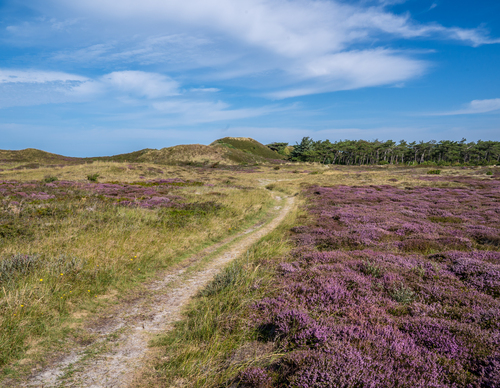
The Bollekamer Walk (blue) follows a grassy track through the vast dune landscape. You walk up and down along dunes and dune pools. The water in the Grote Vlak valley attracts numerous birds. Flowering yellow irises create a colourful backdrop in spring.
2.97 km- (0)
 (deels) gesloten")
Robbengat route (black)
The Robbengat Route (black) is a long circular walk from the village that links the Krimbos nature reserve, the Eierlandse Dunes, the beach and the dike. The lighthouse and Wadden ferry De Vriendschap are also located on the route. This walk shows off the highly varied landscape of the northernmost
11.55 km- (1)