
Search results
Characteristics
Quick search
358 results
Region
Length
Characteristics
 (deels) gesloten")
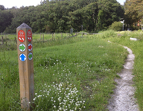
Gemalenroute (blue)
The blue Gemalen Route passes through the long linear village towards Kolhorn. It continues past the disused Schagerkogge pumping station, built in 1927 in Amsterdam School style, then to its predecessor at the Molenkolk (a steam-powered pumping station from 1871) and its successor (the Kolhorn
9.49 km- (11)
 (deels) gesloten")
Oude Veerroute (blue)
The blue Oude Veer Route runs through the Poldertuin and the Kruiszwin to the north-eastern corner of the polder – the village of Van Ewijcksluis on the Balgzand Canal. It then continues along the green Amsteldiepdijk and follows the Lage Oude Veer. The route is waymarked in both directions with
11.65 km- (2)
 (deels) gesloten")
Kneeskaderoute (yellow)
The yellow Kneeskade Route follows the green Noordwesterdijk of the Wieringerwaard towards the village of Oudesluis, on the far side of the Zijperdijk. It continues along the winding Kneeskade to the Hooge Oude Veer. The route is waymarked in both directions with yellow arrows
9.55 km- (2)
 (deels) gesloten")
Poldertuinroute (sea green)
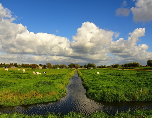
The sea-green Poldertuin Route explores the historic Poldertuin – known as ‘Klein Keukenhof’ – and the adjoining nature area of the reed-fringed Kruiszwin, once a tidal creek in the Balgzand mudflats. The route is waymarked in both directions with sea-green arrows.
5.03 km- (4)
 (deels) gesloten")
Kruiszwinroute (red)
The red Kruiszwin Route explores the historical Poldertuin Anna Paulowna and the adjoining nature area of the reed-fringed Kruiszwin, once a tidal creek in the Balgzand mudflats. The route is waymarked in both directions with red arrows.
2.66 km- (0)
 (deels) gesloten")
Marsdiep Route (blue)
Discover Den Helder through 10 distinctive locations Fishermen, lifeboat crews, shipwrights and the navy have transformed the village of Helder into a town over the past 200 years. Den Helder enjoyed prosperous years until the Second World War. After the war, the heavily bombed town had to be
4.1 km- (0)
 (deels) gesloten")
Willemsoord Route (red)
The red Willemsoord Route explores the south-west side of the former naval dockyard Willemsoord, the Koopvaardershaven and two defence forts: Fort Dirksz Admiraal and Fort Westoever. The route is waymarked in both directions with red arrows.
9.36 km- (1)
 (deels) gesloten")
Westerklief Route (yellow)
The Westerklief Route (yellow) initially follows the Dam Route and then crosses to the hamlet of Westerklief. Considering the silver treasures excavated there, this appears to have been a favourite spot of Vikings in around 850-900. You also walk along a stretch of old seaweed dike (the
9.69 km- (12)
 (deels) gesloten")
Dam Route (blue)
The Dam Route (blue) passes the hamlet of Dam, named after the Korte Afsluitdijk that was built from the mainland to Wieringen in 1924. Via a stretch of Wadden dike (Normerdijk), you come to a curious cross-section of a boulder clay mound: a remnant of the never-completed Zuiderzee railway line
5.86 km- (2)
 (deels) gesloten")
Postbootroute (red)
The Mail Boat Route (red) passes beaches on the Amstelmeer lake, created after the Amsteldiep was closed off in 1924. Down along the Westerlanderdijk you walk to De Haukes, a charming dike village with an old harbour, where the mail boat (postboot) from the mainland used to dock.
3.64 km- (5)