
Search results
Characteristics
Quick search
358 results
Region
Length
Characteristics
 (deels) gesloten")
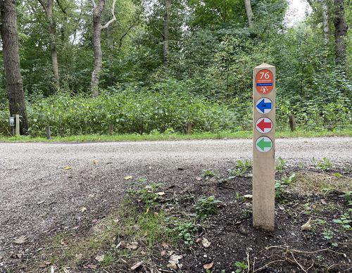
Nieuwe Kom Walk (blue)
The Nieuwe Kom Walk (blue) leads to the radically renewed village centre of Nieuw-Vennep. At the Harmonieplein, the eye is immediately caught by the architecture of the 'Pier K' cultural building. Sturdy hornbeams show the way to the Symfonie shopping centre. It is remarkably green further along on
4.54 km- (2)
 (deels) gesloten")
Spring and Summer Route (green)
The Spring and Summer Route (green) in Nieuw-Vennep brings you to the Lentepark (Spring Park) and the Zomerpark (Summer Park) in Getsewoud-Zuid and also visits the Venneperhout.
3.62 km- (1)
 (deels) gesloten")
Anjer Route (red)
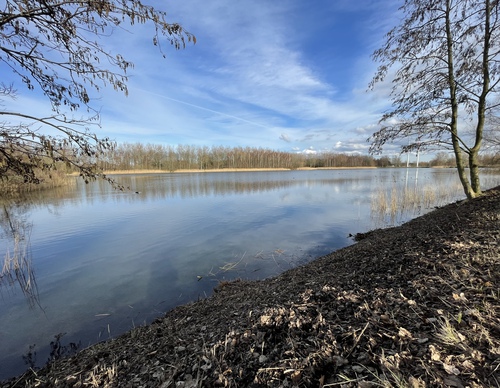
The Anjer Route (red) in the vicinity of Cruquius and Hoofddorp leads around the lake in the Prins Bernhardbos. A forest was created here in a short time by planting already mature trees.
1.75 km- (1)
 (deels) gesloten")
Green Neighbourhood Route (orange)
The Green Neighbourhood Route (orange) gives an impression of the urban developments in Hoofddorp since the 1970s. At that time, the town had about 9,000 inhabitants and now has about ten times as many. The route leads through the neighbourhoods of Pax (1970s), Bornholm and Overbos (1980s),
10.5 km- (2)
 (deels) gesloten")
Geniedijk Route (green)
The Geniedijk Route (green) from starting point Fort bij Hoofddorp leads past the Geniedijk, the Wandelbos walking forest, orchards, a petting zoo and young green spaces developed to compensate for the development of Schiphol airport. Wandelbos Hoofddorp was a job creation project from the crisis
10.09 km- (0)
 (deels) gesloten")
Floriande East Route (blue)
The Floriande East Route (blue) in Hoofddorp goes over the Altenapad and seeks out the sporty and adventurous sides of the Toolenburgerplas lake and PARK21 where swimmers, divers, surfers, climbers, walkers and nature lovers can all enjoy themselves.
8 km- (0)
 (deels) gesloten")
Pioneer Route (yellow)
The Pioneer Route (yellow) leads through the newer neighbourhoods of the Floriande district in Hoofddorp and through the Boseilanden park landscape and the brushland in PARK21, the green area that will reach as far as Nieuw-Vennep. In other words, a pioneering land.
9.14 km- (2)
 (deels) gesloten")
Island Route (purple)
The Island Route (purple) leads to the green region of Boseilanden with its water, forest and even some hills on the western edge of Hoofddorp. Along the way you will also visit two built-up islands. On the wealthy Goeree-Overflakkee you will see a colourful collection of privately-owned dream
5.74 km- (2)
 (deels) gesloten")
Duin en Kruidberg Route (blue)
The Duin en Kruidberg Route (blue) leads through a wooded and open dune region between Santpoort-Noord and Zuid-Kennemerland National Park. The walk shows the dunes in all their guises. Please note: a walking trail near the beach entrance can be flooded for a large part of the year. The route will
11.52 km- (1)
 (deels) gesloten")
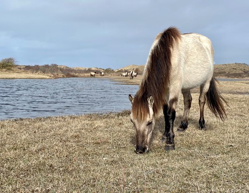
Konik Route (zwart)
The Konik Route (black) is a beautiful circular walk in Zuid-Kennemerland National Park through young and old forest and then continues via Midden-Herenduin to the sandy Starrevlak at Santpoort-Noord.
7.54 km- (5)