
Search results
Characteristics
Quick search
358 results
Region
Length
Characteristics
 (deels) gesloten")
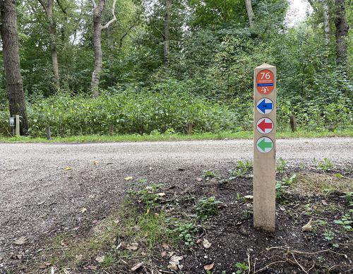
Jaagpad Walk (yellow)
On the Jaagpad Walk (yellow) you stroll on an exclusive walking path along the water. You walk back via the Engelandpark, the Europavaart and the Amerikavaart in Haarlem Schalkwijk.
7.28 km- (6)
 (deels) gesloten")
Vijfhuizer Mill Route (green)
The Vijfhuizer Mill Route (green) in Haarlem Schalkwijk also follows along the shore of the Meerwijkplas but continues all the way to Poelpolder park, along the namesake of the route.
7.2 km- (3)
 (deels) gesloten")
Meerwijkplas Walk (red)
The Meerwijkplas Walk (red) in Haarlem Schalkwijk follows the shoreline of the lake to the Poelbroek park. Because of the high water level, special plants and orchids can be found in the park. The route partly runs over unpaved paths and a section of grassy dike. The cycle path is an alternative
3.16 km- (0)
 (deels) gesloten")
Vossendel walking route (red)
The Vossendel walking route (red) in Driehuis goes through a valley in Zuid-Kennemerland National Park. Vossendel translates as ‘foxes dale’ or ‘foxes valley’ and, although you aren’t likely to encounter a fox, you can see a lot of interesting things along the paths, from snails and
3.13 km- (1)
 (deels) gesloten")
Listen to the birds Route (yellow)
The Listen to the birds Route (yellow) through Zuid-Kennemerland National Park in Driehuis is a short family walk. Learn more at Natuurmonumenten.nl.
2.71 km- (1)
 (deels) gesloten")
Kamperberg Walk (red)
The Kamperberg Walk (red) also follows the canal but goes past the sand excavation farm and into the grazing area with Scottish Highland cattle. This walk also zigzags along the edges of the Duinlust estate in Overveen. The steep descent leads to the former ice cellar on the edge of the forest.
4.21 km- (1)
 (deels) gesloten")
Hoge Duin Walk (blue)
On the Hoge Duin Walk (blue) you first walk a bit along the Zanderijvaart in Overveen. At the Zanderij you will see the dune called Schippersduin. The dune got its name, which means Skipper’s Dune, due to the fact that the sand barge skippers could turn their barges in the water at the base of
3.87 km- (0)
 (deels) gesloten")
Zwaansbroek Route (red)
The Zwaansbroek Route (red) leads to and through the forest north of Lissebroek. Created in 2003, it’s a young forest in full growth and development.
6.66 km- (2)
 (deels) gesloten")
Lisserbroek Route (green)
The Lisserbroek Route (green) leads around Lisserbroek over a few surprising paths, the quiet and winding Turfspoor and along the Ringvaart of the Haarlemmermeer Polder over the bustling Lisserdijk.
5.81 km- (3)
 (deels) gesloten")
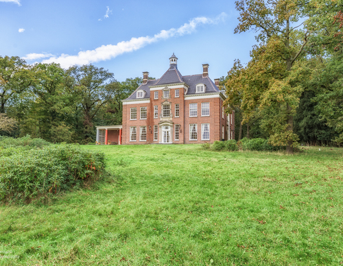
Leyduin Route (red)
The Leyduin Route (red) north of the village of Vogelenzang leads around the nature-rich estate, including the site where there was a horse racing track at the beginning of the last century, complete with grandstand, gambling office and hotel. Photo: Westphil Photography
4.63 km- (4)