
Search results
Characteristics
Quick search
358 results
Region
Length
Characteristics
 (deels) gesloten")
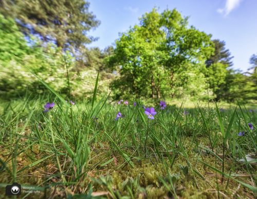
Landgoed Koningshof Route (green
The longer Landgoed Koningshof Route (green) in Overveen goes to the Appelberg near Aerdenhout. You walk over the central meadow, bordered by large trees and shrubs in Zuid-Kennemerland National Park. In the spring, stinsen plants such as lily-of-the-valley and fragrant wild garlic bloom here.
3.66 km- (2)
 (deels) gesloten")
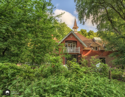
Birds at Koningshof Estate Route (red
You’ll also pass the manor and the coach house on the Birds at Koningshof Estate Route (red) in Overveen. You walk on winding paths and avenues with linden trees and giant beeches in Zuid-Kennemerland National Park. Woodpeckers carve out nesting burrows into dead wood here. The nuthatch is also a
2.36 km- (0)
 (deels) gesloten")
Koningshof Park Forest Walk (blue)
The Koningshof Park Forest Walk (blue) in Overveen is a short walk in Zuid-Kennemerland National Park past the imposing house and along beautiful avenues of trees. You will come across the old coach house along the way.
1.09 km- (1)
 (deels) gesloten")
Dune Ridge Route (yellow)
The Dune Ridge Route (yellow) at Overveen takes you along the flanks of dune ridges that arose between 1400 and 1600. Through thicketed dunes, you walk to the lookout points on the Starreberg and the Konijnenberg in Zuid-Kennemerland National Park. Along the way you will pass vast valleys with
9.84 km- (3)
 (deels) gesloten")
Ten Mountains Route (blue)
The Ten Mountains Route (blue) between Overveen and Bloemendaal connects the edge of the inland dune region with the foredunes along the sea. Wider paths lead through varied landscapes and over dune ridges. There is a huge variety of scenery during this long walk. You pass the ’t Wed dune lake
7.83 km- (4)
 (deels) gesloten")
Konijnenberg Walk (green)
The short Konijnenberg Walk (green) starts at Koevlak in Overveen, where cattle used to graze. From the ’t Wed dune lake, the route goes up to the lookout point on the Konijnenberg. The sandy path up is a workout. In the descent, you walk between pines and oaks to the Rietvlak and back towards
3.64 km- (2)
 (deels) gesloten")
Calatrava Route (black)
The Calatrava Route (black) leads to, through and over the iconic cable-stayed bridge De Harp. It’s something special to walk in a work of art by Santiago Calatrava. The route connects the Kleine Vennep with the old and new centre of Nieuw-Vennep and leads past the Dutch Transport Museum.
7.72 km- (1)
 (deels) gesloten")
Kleine Vennep Route (orange)
The Kleine Vennep Route (orange) in Nieuw-Vennep enters the site via the 'flagpole of the Finnish flag' and heads for the edges of the estate. A connecting green route links with the rest of PARK21 at the Nieuwerkerkertocht.
3.02 km- (1)
 (deels) gesloten")
Small Kleine Vennep Route (purple)
The Small Kleine Vennep Route (purple) does not stray far but still introduces you to the varied plantings of the estate in Nieuw-Vennep.
1.13 km- (0)
 (deels) gesloten")
Houtrak Route (red)
The Houtrak Route (red) at Halfweg is a circular walk that strings together all the exclusive and unpaved walking paths in the area. The walk offers a lot of variety. In some spots, the route goes over grass meadows that can get a bit soggy in wet periods. You can enjoy a drink at the equestrian
5.21 km- (5)