
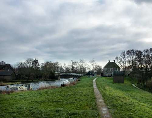
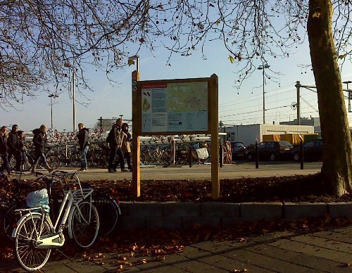
Choose your starting point
The starting points are easily accessible by car and usually also by public transport. Parking is available and you will usually find good catering facilities nearby. At each starting point you will find an information board showing the nicest walking routes in the immediate vicinity. You can choose from an array of circular walks, with distances ranging from 2 to 12 km, all signposted in two directions with coloured arrows.
Prefer a longer walk?
Then a themed route is ideal.
Characteristics
Quick search
139 results


Science Park Station Starting Point
Since the beginning of this century, Amsterdam Science Park has been developed to provide the University of Amsterdam with the kind of space that is difficult to come by in the city centre. The site


Starting point 't Paradijs Hoofddorp
Shopping centre ’t Paradijs is located in the heart of the Overbos district, built in the 1980s, with its many courtyards. It is perhaps the most densely populated and built-up district of

Starting point 't Verlaat
At the former ‘verlaat’ (lock) at Niedorp, vessels could pass through the lock from the Niedorpervaart to the Westerlangereis, and vice versa. In 1942, the waterway was deepened and widened to

Starting Point Aalsmeer Kolenhaven
Between 1915 and 1950, Aalsmeer was a junction on the Haarlemmermeer railway lines. From the terminus on the Stommeerweg you could take the train to Amsterdam, Haarlem and Alphen. The steam trains

Starting point Abbenes
Prior to the land reclamation of the Haarlemmermeer, Abbenes (wet headland of the abbot of Noordwijkerhout) was a sickle-shaped island. The contours are still recognizable. The Hoofdvaart canal cuts

Starting point Alkmaar Station
A railway line between Amsterdam and the port of Den Helder became necessary in the second half of the 19th century. That’s why Alkmaar got a railway line to Den Helder in 1865 and later to

Starting Point Amstelveen Brink
The Middenhoven and Waardhuizen districts are located in the heart of the Bovenkerkerpolder at about 5 metres below sea level (Amsterdam Ordnance Datum or NAP). This difference in height is

Starting Point Amstelveen Town Hall
“Amstelveen, the largest village in the municipality of Nieuwer-Amstel, is located on the De Poel lake and the railway line between Amsterdam and Alphen aan den Rijn.” That description was

Starting point Anna Paulowna
This starting point lies beside the oldest church in Anna Paulowna, built between 1853 and 1855. When the land was reclaimed in 1846, few people lived here. A village soon grew around the Kleine

Starting point Barsingerhorn
Barsingerhorn is a Provincially Protected Village Conservation Area for a reason – the first and only one in Noord-Holland. This east–west linear village, with its stolp farmhouses –