
Choose your starting point
The starting points are easily accessible by car and usually also by public transport. Parking is available and you will usually find good catering facilities nearby. At each starting point you will find an information board showing the nicest walking routes in the immediate vicinity. You can choose from an array of circular walks, with distances ranging from 2 to 12 km, all signposted in two directions with coloured arrows.
Prefer a longer walk?
Then a themed route is ideal.
Characteristics
Quick search
139 results


Starting point Quaatrebas Badhoevedorp
In just 10 years, Badhoevedorp has been completely turned around. Until April 2017, highway traffic rushed right through the village. Something that is unimaginable now. A lot has been built in a

Starting point Reinaldapark Haarlem
The trendy Reinaldapark is named after a former mayor of Haarlem. What was once a landfill has been cleverly transformed into an attractive neighbourhood park with winding paths around the Fuikplas.
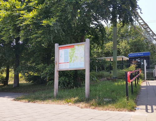

Starting point Santpoort-Noord Station
Santpoort-Noord is surrounded by greenery. To the west lies the Landgoed Duin en Kruidberg estate with its impressive manor house and the ornate garden, created by landscape architect Springer. Duin

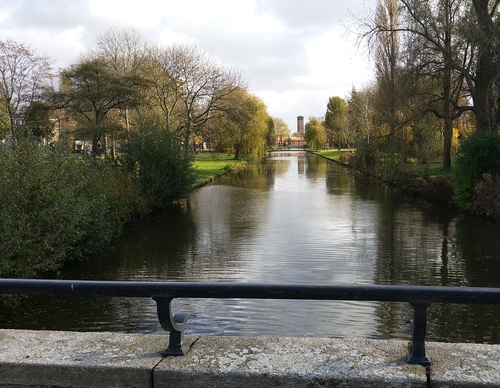
Starting point Spaarndam
Spaarndam is located between dikes and locks at the mouth of Liede and Spaarne in the IJ. This part of Holland was already battling against the water in the Middle Ages. The village is located at the

Starting point Station Santpoort-Zuid (tourist transfer point)
Santpoort-Zuid is located at the inland dune region. To the north is the Burgemeester Rijkenspark, a green remnant of Buitenplaats Spaarnberg: a former linen bleaching house that was transformed into

Starting point The Fort bij Hoofddorp
The Fort bij Hoofddorp is part of the Defence Line of Amsterdam and was built at the end of the 19th century to defend the capital. From the fort, they guarded the flood sluice in the Hoofdvaart. The

Starting point Tooleburg Hoofddorp
The Toolenburgerplas is an artificial lake created by sand extraction for the districts of Toolenburg and Floriande and was only commissioned for recreational use in 2003. In the future, the lake

Starting point Veerplas Haarlem (tourist transfer point)
The Veerplas on the edge of the Waarderpolder is a popular recreation spot for many Haarlem residents. In the winter, the lake is the domain of large numbers of grey geese and wigeon ducks. From the

Starting point Venneperhout Nieuw-Vennep (tourist transfer point)
The Venneperhout was first water, then arable land and now a polder forest. Construction started in 2003. The result is a varied park forest on the edge of Nieuw-Vennep with some brushland. It’s

Starting point Vijfhuizen
It might be hard to imagine here amongst the new housing estates, but Vijfhuizen already existed before the reclamation. At that time, the centre was a little further north on a headland in the