
Choose your starting point
The starting points are easily accessible by car and usually also by public transport. Parking is available and you will usually find good catering facilities nearby. At each starting point you will find an information board showing the nicest walking routes in the immediate vicinity. You can choose from an array of circular walks, with distances ranging from 2 to 12 km, all signposted in two directions with coloured arrows.
Prefer a longer walk?
Then a themed route is ideal.
Characteristics
Quick search
139 results
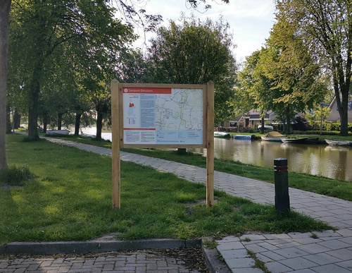

Starting Point Dirkshorn
Dirkshorn developed along the Oosterdijk of the Geestmerambacht. The dyke village was probably named after a horn or projecting piece of land associated with a man called Dierick or Diederik. It lay
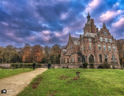

Starting point Duin en Kruidberg Santpoort-Noord
The Landgoed Duin en Kruidberg estate in Santpoort-Noord has a rich history. The hilly dunes were part of the hunting domain of William III, the Prince of Orange. At that time, it was called

Starting Point Eenigenburg
Eenigenburg is a medieval village built on raised mounds, with a rich history. In 1289 it was known as Eini(g)hborg and in 1600 as Eenighenburg. The name means ‘burcht nige Ee’, Old Frisian for

Starting point Enkhuizen Station
Walking through Enkhuizen is walking through the Golden Age. The town flourished in the 17th century, mainly due to its profitable herring fishing. Everywhere in the town centre there are still


Starting point Floriande Hoofddorp
Floriande in Hoofddorp is an archipelago built between 2000 and 2008 and is also the Haarlemmermeer district’s largest Vinex (housing development programme) neighbourhood. Characteristic of the

Starting Point Fort Kijkduin
The seaside resort of Huisduinen lies on the Marsdiep, the sea channel between Den Helder and Texel. Before the construction of the Zanddijk to Groote Keeten in 1612, Huisduinen – then known as
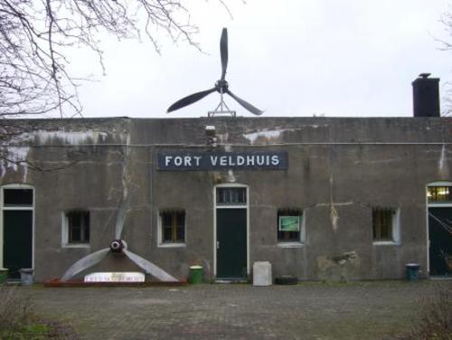

Starting Point Fort Veldhuis-Aagtendijk
Fort bij Veldhuis (1893) is one of the oldest forts from the Stelling van Amsterdam, a line of defence created between 1880 and 1914, with an area 3-5 kilometres wide around the capital that could be

Starting point Getsewoud Nieuw-Vennep
Getsewoud offers a fine example of modern urban planning, with varied architecture, space, water, greenery and footpaths. Construction started in 1998, after which the population of Nieuw-Vennep

Starting point Groene Weelde (tourist transfer point)
Groene Weelde is the name of the park area that was created in the run-up to the Floriade that was held here and in the adjacent Haarlemmermeerse Bos in 2002. Two routes depart from this point, the

Starting point Haarlem Station
Haarlem is blessed with greenery and water extending into the heart of the city centre, which is a treat for walkers. The Bolwerkplantsoen on the former ramparts is especially worth a detour. It is